Introduction
Uttar Pradesh, India’s most populous state, exhibits significant geographical diversity. The state can be broadly divided into several major physical regions based on topography, climate, and soil characteristics. Understanding these divisions provides insight into the region’s economic activities, biodiversity, and environmental concerns.
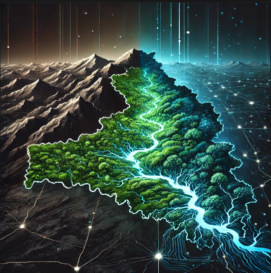
Major Physical Regions of Uttar Pradesh
- The Gangetic Plain
- Covers most of the state and is characterized by fertile alluvial soil.
- Subdivided into Upper, Middle, and Lower Gangetic Plains.
- Major rivers include the Ganga, Yamuna, and their tributaries.
- This region is the backbone of agriculture in Uttar Pradesh, supporting crops such as wheat, rice, sugarcane, and pulses.
- It also houses major urban centers like Lucknow, Kanpur, and Varanasi, which contribute significantly to the state’s economy.
- Covers most of the state and is characterized by fertile alluvial soil.
- The Bhabar Region
- Lies at the foothills of the Himalayas, forming a narrow strip.
- Composed of porous and rocky deposits, making it unsuitable for agriculture.
- Acts as a natural drainage belt where rivers disappear underground before re-emerging in the Terai.
- Characterized by sparse vegetation, with certain patches supporting forestry activities.
- Human settlements in this region are relatively low due to the infertile soil and lack of perennial water sources.
- Lies at the foothills of the Himalayas, forming a narrow strip.
- The Terai Region
- Located south of the Bhabar, characterized by marshy and swampy lands.
- Rich in biodiversity and supports extensive agriculture due to high water retention.
- A major hub for sugarcane farming due to the abundance of moisture and fertile soil.
- Dense forests in some parts of Terai serve as sanctuaries for wildlife, including tigers, elephants, and several migratory birds.
- Due to its rich resources, this region has witnessed deforestation and human encroachment, leading to environmental concerns.
- Located south of the Bhabar, characterized by marshy and swampy lands.
- The Vindhyan Region
- Located in the southern part of Uttar Pradesh.
- Features hilly and rugged terrain, primarily composed of sandstone and limestone.
- Rich in minerals such as bauxite, silica, and dolomite, supporting the mining industry.
- Sparse population density due to difficult terrain and lower agricultural potential.
- Supports dryland farming and minor forest-based economic activities.
- Located in the southern part of Uttar Pradesh.
- The Bundelkhand Plateau
- A semi-arid region characterized by rocky land and sparse vegetation.
- Known for water scarcity issues despite the presence of seasonal rivers.
- Faces frequent drought conditions, leading to distress migration of the population to urban centers in search of employment.
- Efforts are being made to develop water conservation methods, including rainwater harvesting and check dams, to mitigate water shortages.
- The region has a historical significance, with several forts and temples that attract tourism.
- A semi-arid region characterized by rocky land and sparse vegetation.
- The Eastern Plateau and Hills
- Includes districts like Sonbhadra and Mirzapur.
- Rich in minerals and forest cover, supporting mining activities.
- Known for its picturesque landscapes, waterfalls, and dense forests.
- Faces challenges related to deforestation and illegal mining.
- Includes districts like Sonbhadra and Mirzapur.
Geographical Features of the Bhabar Region
The Bhabar region is a narrow, porous belt located at the foothills of the Himalayas. It serves as a transition zone between the mountainous terrain and the plains. Key geographical characteristics include:
- Topography and Composition
- Formed by the deposition of coarse sediments such as gravel and pebbles.
- Highly porous, resulting in the quick percolation of surface water into underground reserves.
- The undulating landscape prevents major settlements from developing extensively.
- Formed by the deposition of coarse sediments such as gravel and pebbles.
- Hydrology
- Rivers originating from the Himalayas lose their flow upon reaching this region due to porosity.
- Acts as a recharge zone for underground aquifers, supplying water to lower plains.
- Periodic flash floods occur in certain areas due to heavy rainfall in the hills.
- Rivers originating from the Himalayas lose their flow upon reaching this region due to porosity.
- Soil and Vegetation
- Soil is largely infertile, making agriculture challenging.
- Sparse vegetation, with patches of forests in some areas.
- Supports certain tree species like sal and teak, which are valuable for timber production.
- Soil is largely infertile, making agriculture challenging.
- Economic Activities
- Limited agriculture due to poor soil fertility.
- Forestry and cattle grazing are prominent.
- Some areas have been developed for tourism, especially eco-tourism and adventure sports.
- Limited agriculture due to poor soil fertility.
Geographical Features of the Terai Region
The Terai region lies south of the Bhabar belt and is characterized by its marshy and fertile landscape. Key geographical features include:
- Topography and Composition
- Formed by fine alluvial deposits carried down by Himalayan rivers.
- Low-lying and prone to waterlogging, leading to marshy conditions.
- Gradual slope and flat terrain make it suitable for agriculture.
- Formed by fine alluvial deposits carried down by Himalayan rivers.
- Hydrology
- Unlike Bhabar, rivers do not disappear but instead create numerous streams and swamps.
- Rich in groundwater, making it an essential agricultural zone.
- Prone to seasonal flooding, affecting settlements and farmlands.
- Unlike Bhabar, rivers do not disappear but instead create numerous streams and swamps.
- Soil and Vegetation
- Fertile alluvial soil supports intensive farming.
- Dense forests in some areas provide habitat for diverse wildlife.
- Supports the cultivation of high-yield crops like rice, wheat, sugarcane, and mustard.
- Fertile alluvial soil supports intensive farming.
- Economic Activities
- Major crops include sugarcane, wheat, rice, and maize.
- Forestry, fisheries, and dairy farming thrive due to abundant water.
- Home to major wildlife reserves, such as Dudhwa National Park, which supports eco-tourism.
- Increased deforestation and land conversion for agriculture have led to significant biodiversity loss.
- Major crops include sugarcane, wheat, rice, and maize.
Conclusion
Uttar Pradesh’s physical geography plays a crucial role in shaping its economic and environmental landscape. While the Bhabar region acts as a natural filter and recharge zone, the Terai region supports agriculture and biodiversity. The state’s diverse physical regions influence settlement patterns, resource distribution, and economic activities. Understanding these regions is essential for sustainable development and environmental conservation efforts in the state. Policies focusing on water conservation, afforestation, and sustainable agricultural practices are crucial to maintaining ecological balance while promoting economic growth.