Understanding how locations are identified on Earth is a fundamental aspect of geography. Latitude and longitude are the two primary coordinates that help us determine the exact position of any place on the globe. These imaginary lines, drawn across maps and globes, serve as the foundation for navigation, cartography, geopolitics, and even timekeeping.
1. Introduction to the Geographic Coordinate System
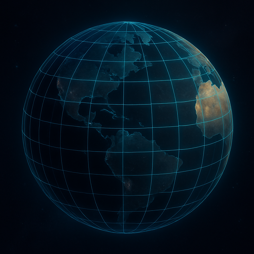
The Earth is a three-dimensional sphere, and locating places on its curved surface requires a coordinate system. The geographic coordinate system uses angular measurements to pinpoint any location using two values: latitude and longitude.
- Latitude measures how far north or south a location is from the Equator.
- Longitude measures how far east or west a location is from the Prime Meridian.
Together, these two values form a pair of coordinates (e.g., 28.6139° N, 77.2090° E for New Delhi), which uniquely identifies a point on Earth.
2. Latitude: Definition and Characteristics
2.1. What is Latitude?
Latitude is the angular distance of a point north or south of the Earth’s Equator. It is measured in degrees (°), from 0° at the Equator to 90° at the poles.
2.2. Key Lines of Latitude
- Equator (0°) – Divides Earth into the Northern and Southern Hemispheres.
- Tropic of Cancer (23.5° N) – Northern boundary of the tropics.
- Tropic of Capricorn (23.5° S) – Southern boundary of the tropics.
- Arctic Circle (66.5° N) – Marks the polar day/night zones in the north.
- Antarctic Circle (66.5° S) – Marks the polar day/night zones in the south.
- North Pole (90° N) and South Pole (90° S) – The extreme limits of latitude.
2.3. Characteristics of Latitude Lines
- They run horizontally, parallel to the Equator.
- All lines of latitude are circles, but only the Equator is a great circle (largest possible circle on a sphere).
- Latitude lines become smaller as they move toward the poles.
- They help define climatic zones:
- Tropical Zone (between Tropics)
- Temperate Zones (between tropics and circles)
- Polar Zones (within the Arctic/Antarctic circles)
3. Longitude: Definition and Characteristics
3.1. What is Longitude?
Longitude is the angular distance of a point east or west of the Prime Meridian, which is the 0° longitude line that runs through Greenwich, London.
It is measured in degrees (°) from 0° to 180° east or west.
3.2. Key Meridians
- Prime Meridian (0°) – Passes through the Royal Observatory in Greenwich, England.
- 180th Meridian (180° E/W) – Roughly corresponds to the International Date Line.
3.3. Characteristics of Longitude Lines
- They run vertically from the North Pole to the South Pole.
- Unlike latitude, all longitudes are equal in length.
- All meridians meet at the poles, creating a semi-circular shape.
- Longitude determines time zones, as the Earth rotates 15° every hour.
4. Understanding Degrees, Minutes, and Seconds (DMS)
Coordinates can be written in Decimal Degrees (DD) or Degrees, Minutes, Seconds (DMS).
Decimal Degrees (DD):
Example: 28.6139° N, 77.2090° E
Degrees, Minutes, Seconds (DMS):
Example: 28°36’50” N, 77°12’32” E
- 1 degree = 60 minutes (‘)
- 1 minute = 60 seconds (“)
This system provides highly accurate pinpointing of locations.
5. Uses and Applications of Latitude and Longitude
5.1. Navigation and GPS
Modern Global Positioning Systems (GPS) rely on latitude and longitude to provide real-time location data for:
- Ships
- Aircraft
- Smartphones
- Military operations
5.2. Cartography and Mapping
Mapmakers use this coordinate system to:
- Create accurate maps
- Measure distances
- Define borders
5.3. Astronomy and Satellites
In space science:
- Coordinates help track satellite orbits
- Predict eclipse paths
- Align telescopes
5.4. Environmental Studies
Scientists use location data to:
- Track climate patterns
- Monitor deforestation
- Study biodiversity distribution
5.5. Disaster Management
Helps identify:
- Earthquake epicenters
- Cyclone paths
- Flood-prone regions
5.6. Urban Planning
Used in:
- Designing road networks
- Utility services
- Setting zoning regulations
6. Time and Longitude: The Connection
6.1. Why Time Zones Exist
The Earth takes 24 hours to complete one rotation (360°).
Thus, every 15° of longitude equals one hour of time difference.
6.2. Standard Time and the Prime Meridian
- The Prime Meridian (0°) is the reference point for Greenwich Mean Time (GMT) or Universal Time Coordinated (UTC).
- Countries define Standard Time based on their longitude.
For example:
- India (82.5° E) = UTC +5:30
- Japan (135° E) = UTC +9
7. Great Circles and Small Circles
Great Circle:
- Any circle that divides the Earth into two equal halves.
- Only the Equator and any longitude pair form great circles.
Small Circle:
- Any circle that doesn’t pass through the center of the Earth.
- All other lines of latitude are small circles.
Great circles are the shortest path between two points on Earth — important in air navigation.
8. The Global Grid
When latitude and longitude lines intersect, they form a global grid.
This grid helps:
- Determine the precise location of any point
- Establish geographic boundaries
- Facilitate navigation and remote sensing
9. Fun Facts and Curiosities
- The Equator is about 40,075 km in circumference.
- There are 360 degrees of longitude, but only 181 lines of latitude.
- The North Pole and South Pole are single points (90° N and 90° S) — all longitudes converge there.
- GPS systems rely on satellites and ground stations, which constantly use coordinate data.
10. Educational Importance
For students preparing for competitive exams like UPSC, SSC, or State PCS (like UPPCS), understanding latitude and longitude is crucial for:
- Map-based questions
- Indian and world geography
- Climate zones
- Navigation and positioning questions
Additionally, this topic builds a foundation for advanced studies in:
- Geology
- Oceanography
- Meteorology
- Environmental sciences
Conclusion
Latitude and longitude are more than just imaginary lines — they are the backbone of geographic science. From ancient mariners to modern satellites, the coordinate system has been instrumental in helping humanity navigate, explore, and understand the world. A solid grasp of this system not only aids academic pursuits but also enhances global awareness and critical thinking in spatial contexts.