Introduction
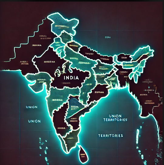
India, the seventh-largest country in the world, is known for its vast geographical expanse and diverse culture. Administratively, India is divided into 28 states and 8 Union Territories (UTs) as of today. The country has undergone multiple reorganizations since independence in 1947, shaping its current political structure. This article delves into the historical evolution, classification, governance, and significance of states and union territories in India.
Evolution of Indian States and Union Territories
Post-Independence Scenario (1947-1956)
At the time of independence, India was a collection of over 500 princely states and British provinces. The process of integrating these territories into a unified nation was led by Sardar Vallabhbhai Patel. By 1950, India was reorganized into Part A, Part B, Part C, and Part D states under the Constitution of India:
- Part A States: Former British provinces (e.g., Bombay, Madras, Bengal)
- Part B States: Former princely states governed by Rajpramukhs (e.g., Hyderabad, Mysore)
- Part C States: Smaller states governed by Chief Commissioners (e.g., Delhi, Himachal Pradesh)
- Part D Territory: Andaman and Nicobar Islands
Reorganization of States (1956)
The States Reorganization Act, 1956, played a pivotal role in shaping the current map of India. This act reorganized states based on linguistic lines, leading to the dissolution of the old classification. It resulted in the creation of new states, merging of regions, and a clear distinction between states and union territories.
List of 28 States in India and Their Capitals
Below is the list of the 28 states along with their respective capitals:
| State | Capital |
|---|---|
| Andhra Pradesh | Amaravati |
| Arunachal Pradesh | Itanagar |
| Assam | Dispur |
| Bihar | Patna |
| Chhattisgarh | Raipur |
| Goa | Panaji |
| Gujarat | Gandhinagar |
| Haryana | Chandigarh |
| Himachal Pradesh | Shimla |
| Jharkhand | Ranchi |
| Karnataka | Bengaluru |
| Kerala | Thiruvananthapuram |
| Madhya Pradesh | Bhopal |
| Maharashtra | Mumbai |
| Manipur | Imphal |
| Meghalaya | Shillong |
| Mizoram | Aizawl |
| Nagaland | Kohima |
| Odisha | Bhubaneswar |
| Punjab | Chandigarh |
| Rajasthan | Jaipur |
| Sikkim | Gangtok |
| Tamil Nadu | Chennai |
| Telangana | Hyderabad |
| Tripura | Agartala |
| Uttar Pradesh | Lucknow |
| Uttarakhand | Dehradun |
| West Bengal | Kolkata |
Each state has its own government and is headed by a Chief Minister (CM). The states have independent legislative, executive, and judicial structures.
List of 8 Union Territories in India and Their Capitals
Union Territories (UTs) are regions governed directly by the Central Government of India. Unlike states, which have their own elected governments, some UTs are administered by Lieutenant Governors (LGs) or Administrators appointed by the President of India.
Here is the list of 8 Union Territories with their capitals:
| Union Territory | Capital |
| Andaman and Nicobar Islands | Port Blair |
| Chandigarh | Chandigarh |
| Dadra and Nagar Haveli and Daman and Diu | Daman |
| Lakshadweep | Kavaratti |
| Delhi | New Delhi |
| Puducherry | Puducherry |
| Jammu and Kashmir | Srinagar (Summer), Jammu (Winter) |
| Ladakh | Leh |
Union Territories with Legislative Assemblies
Not all UTs are administered directly by the Central Government. Some have been granted partial statehood with elected legislatures and Chief Ministers. These include:
- Delhi (National Capital Territory) – Governed by an elected CM and LG
- Puducherry – Has an elected government
- Jammu and Kashmir – Became a UT in 2019 but has its own legislature
Difference Between States and Union Territories
| Feature | States | Union Territories |
| Governance | Governed by an elected government | Directly controlled by the Central Government (except those with legislatures) |
| Chief Executive | Chief Minister | Lieutenant Governor or Administrator |
| Legislative Powers | Full legislative authority | Limited or no legislative power (except Delhi, Puducherry, J&K) |
| Autonomy | More autonomy in governance | Lesser autonomy, under central control |
| Examples | Maharashtra, Karnataka, Uttar Pradesh | Delhi, Chandigarh, Ladakh |
Why Are Some Regions Union Territories Instead of States?
Some regions are designated as Union Territories due to:
- Strategic Location: Regions like Andaman and Nicobar Islands and Lakshadweep are of national security importance.
- Small Population: Regions with a small population and land area, such as Chandigarh and Dadra & Nagar Haveli, do not require a full-fledged state administration.
- Political and Administrative Control: Delhi, being the national capital, requires direct central oversight for governance and security.
Recent Changes in the Number of States and UTs
Formation of Telangana (2014)
Telangana became the 29th state of India on June 2, 2014, after being separated from Andhra Pradesh. The capital of Telangana is Hyderabad.
Reorganization of Jammu & Kashmir and Ladakh (2019)
On August 5, 2019, the Government of India abrogated Article 370, which granted special status to Jammu and Kashmir. As a result:
- Jammu and Kashmir was reorganized into a Union Territory with a legislature.
- Ladakh was separated and made a Union Territory without a legislature.
This reduced the number of states from 29 to 28 and increased the number of Union Territories from 7 to 8.
Conclusion
India’s 28 states and 8 Union Territories play a crucial role in governance, administration, and cultural identity. The states have full legislative autonomy, whereas Union Territories are directly governed by the Central Government with varying levels of administrative control. Over the years, India has witnessed several reorganizations to accommodate linguistic, political, and geographical considerations.
Understanding the administrative division of India is essential for competitive exams, governance studies, and general knowledge. Future changes in state boundaries and governance structures are always a possibility as India continues to evolve as a federal democracy.