Orbiting silently above our heads, a network of sophisticated artificial sentinels – satellites – has woven itself into the very fabric of our modern existence. Far from being mere futuristic novelties, these technological marvels have become indispensable pillars, fundamentally reshaping two critical domains: the way we communicate across vast distances and the intricate processes of cultivating the land that sustains us. This in-depth exploration will navigate the diverse applications of satellite technology in both communication and agriculture, illuminating its profound impact and hinting at the exciting possibilities that lie ahead.
I. Celestial Mechanics and Terrestrial Needs: Understanding the Satellite Ecosystem:
To truly appreciate the transformative power of satellites, it’s crucial to first grasp the underlying principles that govern their operation and the intricate machinery that constitutes them.
- Dancing in the Void: Orbital Dynamics: Satellites are not randomly scattered across the cosmos; their placement follows precise orbital paths dictated by gravitational forces and mission objectives. Geostationary Earth Orbit (GEO) satellites, perched at an altitude of approximately 35,786 kilometers directly above the equator, possess the unique characteristic of remaining fixed relative to a point on Earth. This stable positioning makes them ideal for continuous broadcasting and telecommunications services. In contrast, Medium Earth Orbit (MEO) and Low Earth Orbit (LEO) satellites circle closer to our planet. Due to their lower altitude and faster orbital speeds, constellations of these satellites are required to provide uninterrupted global coverage, as exemplified by satellite navigation systems like the ubiquitous GPS and burgeoning low-latency internet constellations. Finally, Sun-synchronous orbits, a type of polar orbit, ensure that a satellite passes over any given point on Earth at roughly the same local time each day, making them invaluable for consistent Earth observation and environmental monitoring.
- Intricate Engineering: The Anatomy of a Satellite: Each satellite is a self-contained technological marvel, comprising several interconnected subsystems working in concert:
- The Mission Heart: Payload: This is the core purpose of the satellite – the specific equipment designed to fulfill its mission. For communication satellites, this includes transponders that receive, amplify, and retransmit signals. For Earth observation satellites, it encompasses a variety of sophisticated sensors capable of capturing different types of electromagnetic radiation. Scientific satellites carry instruments for conducting research in space.
- The Supporting Framework: Bus (or Platform): This vital component provides the essential infrastructure for the payload to function. It includes the power system (typically solar panels converting sunlight into electricity), the propulsion system for initial orbit insertion and subsequent adjustments, the attitude control system to maintain precise orientation in space, the thermal control system to regulate internal temperatures in the harsh vacuum of space, and the telemetry, tracking, and command (TT&C) system that facilitates communication with ground control.
- The Mission Heart: Payload: This is the core purpose of the satellite – the specific equipment designed to fulfill its mission. For communication satellites, this includes transponders that receive, amplify, and retransmit signals. For Earth observation satellites, it encompasses a variety of sophisticated sensors capable of capturing different types of electromagnetic radiation. Scientific satellites carry instruments for conducting research in space.
- Bridging the Gap: Ground Segment Infrastructure: The satellites themselves are only one part of the equation. A network of ground stations strategically located across the globe forms the crucial link between the orbiting sentinels and terrestrial users. Large teleports with powerful antennas communicate with communication satellites, while smaller receiving stations collect the vast amounts of data transmitted by Earth observation satellites. Control centers manage satellite operations, monitor their health, and process the received data.
II. Connecting the World: Satellite Technology as a Communication Catalyst:
The launch of the first communication satellites irrevocably altered the landscape of global interaction, collapsing geographical barriers and ushering in an era of near-instantaneous information exchange.
- Broadcasting Without Boundaries: Communication satellites act as high-altitude relay points, receiving signals from an uplink station and retransmitting them to a potentially vast downlink area. This capability underpins:
- Television and Radio Distribution: Satellites deliver television and radio broadcasts to millions of homes, particularly in regions where laying extensive terrestrial cable infrastructure is economically unfeasible or geographically challenging. Direct-to-home (DTH) satellite television services are a testament to this widespread application.
- Bridging the Digital Divide: In remote and underserved communities, satellites provide essential pathways for accessing information and entertainment, overcoming the limitations of terrestrial networks.
- Emergency Communication: During natural disasters that cripple ground-based infrastructure, satellite communication can provide vital links for emergency responders and affected populations.
- Television and Radio Distribution: Satellites deliver television and radio broadcasts to millions of homes, particularly in regions where laying extensive terrestrial cable infrastructure is economically unfeasible or geographically challenging. Direct-to-home (DTH) satellite television services are a testament to this widespread application.
- Voice and Data Across Continents: Satellites provide crucial backbones for voice calls and internet access, especially in areas where traditional landlines and fiber optic cables are absent.
- Remote Connectivity: Maritime vessels, aircraft, and isolated land-based operations rely on satellite communication for essential connectivity.
- Disaster Recovery: Satellite networks offer resilient communication alternatives when terrestrial systems fail, ensuring continuity of critical services.
- Evolving Internet Solutions: Newer generations of satellite internet services, particularly those utilizing LEO constellations, promise lower latency and higher bandwidth, potentially offering competitive broadband options even in densely populated areas.
- Remote Connectivity: Maritime vessels, aircraft, and isolated land-based operations rely on satellite communication for essential connectivity.
- Precise Positioning: The Foundation of Modern Navigation: Global Navigation Satellite Systems (GNSS), such as the US-operated GPS, Russia’s GLONASS, Europe’s Galileo, and China’s BeiDou, rely on a constellation of satellites broadcasting precise timing signals. Receivers on the ground use these signals to calculate their exact location and time. This fundamental technology underpins a vast array of communication-related applications:
- Mapping and Spatial Intelligence: Satellite-derived location data is the bedrock of modern mapping applications, Geographic Information Systems (GIS), and location-based services used in urban planning, environmental analysis, and resource management.
- Efficient Transportation and Logistics: Navigation satellites enable precise tracking of vehicles, ships, and aircraft, optimizing routes and improving the efficiency of transportation networks and supply chains.
- Critical Emergency Response: The ability to pinpoint the location of individuals in distress is paramount for effective search and rescue operations.
- Mapping and Spatial Intelligence: Satellite-derived location data is the bedrock of modern mapping applications, Geographic Information Systems (GIS), and location-based services used in urban planning, environmental analysis, and resource management.
III. Cultivating with Cosmic Insight: Satellite Technology in the Realm of Agriculture:
Beyond communication, satellite technology has emerged as an indispensable ally in the quest to feed a growing global population sustainably and efficiently.
- Eyes in the Sky: Earth Observation for Agricultural Intelligence: Satellites equipped with sophisticated remote sensing instruments act as vigilant observers of our planet’s surface, collecting a wealth of data relevant to agricultural practices. These sensors capture electromagnetic radiation across various spectral bands, allowing for the assessment of crucial agricultural parameters:
- Plant Health and Vigor Assessment: By analyzing the way vegetation reflects sunlight in different wavelengths, scientists can derive vegetation indices like the Normalized Difference Vegetation Index (NDVI). These indices provide quantitative measures of plant health, biomass, and photosynthetic activity, enabling the early detection of stress factors such as nutrient deficiencies, water scarcity, diseases, and pest infestations.
- Mapping Land Use and Crop Types: High-resolution satellite imagery allows for the creation of detailed maps delineating different agricultural land uses and identifying specific crop types grown in a region. This information is vital for agricultural planning, yield estimation, and monitoring land-use changes.
- Understanding Soil Conditions: Certain satellite sensors can provide estimates of surface soil moisture content and temperature, critical factors influencing seed germination, plant growth, and irrigation requirements.
- Monitoring Water Resources for Irrigation: Satellite data can track the extent and health of water bodies used for irrigation, monitor snowmelt contributing to water supply, and even provide insights into groundwater levels, aiding in efficient water resource management and drought monitoring.
- Predicting the Harvest: Yield Forecasting: By integrating satellite-derived data on crop health, historical yield information, and meteorological forecasts, sophisticated agricultural models can generate more accurate predictions of crop yields, assisting in market planning, storage management, and ensuring food security.
- Plant Health and Vigor Assessment: By analyzing the way vegetation reflects sunlight in different wavelengths, scientists can derive vegetation indices like the Normalized Difference Vegetation Index (NDVI). These indices provide quantitative measures of plant health, biomass, and photosynthetic activity, enabling the early detection of stress factors such as nutrient deficiencies, water scarcity, diseases, and pest infestations.
- Tailoring Inputs: The Precision Agriculture Revolution: Satellite-derived insights are a cornerstone of precision agriculture, a management paradigm that leverages technology to optimize agricultural inputs and practices at a granular, site-specific level within a field. This approach aims to:
- Variable Rate Application (VRA) of Resources: Based on detailed maps of soil properties, nutrient availability, and crop health derived from satellite imagery, farmers can utilize VRA technology to apply fertilizers, pesticides, and irrigation water at varying rates across different zones within a field. This targeted application maximizes resource use efficiency, reduces waste, and minimizes environmental impact.
- Pinpointing Threats: Targeted Pest and Disease Management: Early identification of stressed vegetation through satellite imagery enables farmers to focus scouting efforts and apply pest control measures only in affected areas, reducing the overall use of potentially harmful chemicals.
- Optimizing Water Use: Precision Irrigation: Satellite-based soil moisture data and evapotranspiration estimates empower farmers to schedule irrigation more precisely, delivering the right amount of water at the right time to specific areas, conserving precious water resources and enhancing crop yields.
- Variable Rate Application (VRA) of Resources: Based on detailed maps of soil properties, nutrient availability, and crop health derived from satellite imagery, farmers can utilize VRA technology to apply fertilizers, pesticides, and irrigation water at varying rates across different zones within a field. This targeted application maximizes resource use efficiency, reduces waste, and minimizes environmental impact.
- Managing Grazing Lands: Satellite Support for Livestock: Satellite technology also offers valuable tools for sustainable livestock management:
- Assessing Pasture Health and Availability: Satellite imagery can monitor the greenness and biomass of grazing lands, providing insights into pasture health and carrying capacity, helping farmers optimize grazing rotations and prevent overgrazing.
- Tracking Animal Movements (Emerging Applications): While not yet widespread, satellite-based tracking devices are being explored for monitoring the movement and behavior of livestock in large rangeland environments.
- Assessing Pasture Health and Availability: Satellite imagery can monitor the greenness and biomass of grazing lands, providing insights into pasture health and carrying capacity, helping farmers optimize grazing rotations and prevent overgrazing.
- Mitigating Risks: Satellite Data for Agricultural Insurance: Objective and spatially explicit data derived from Earth observation satellites provides a reliable basis for agricultural insurance assessments. Satellite imagery can document the extent and severity of crop damage caused by natural disasters, facilitating more accurate and timely claim processing for affected farmers.
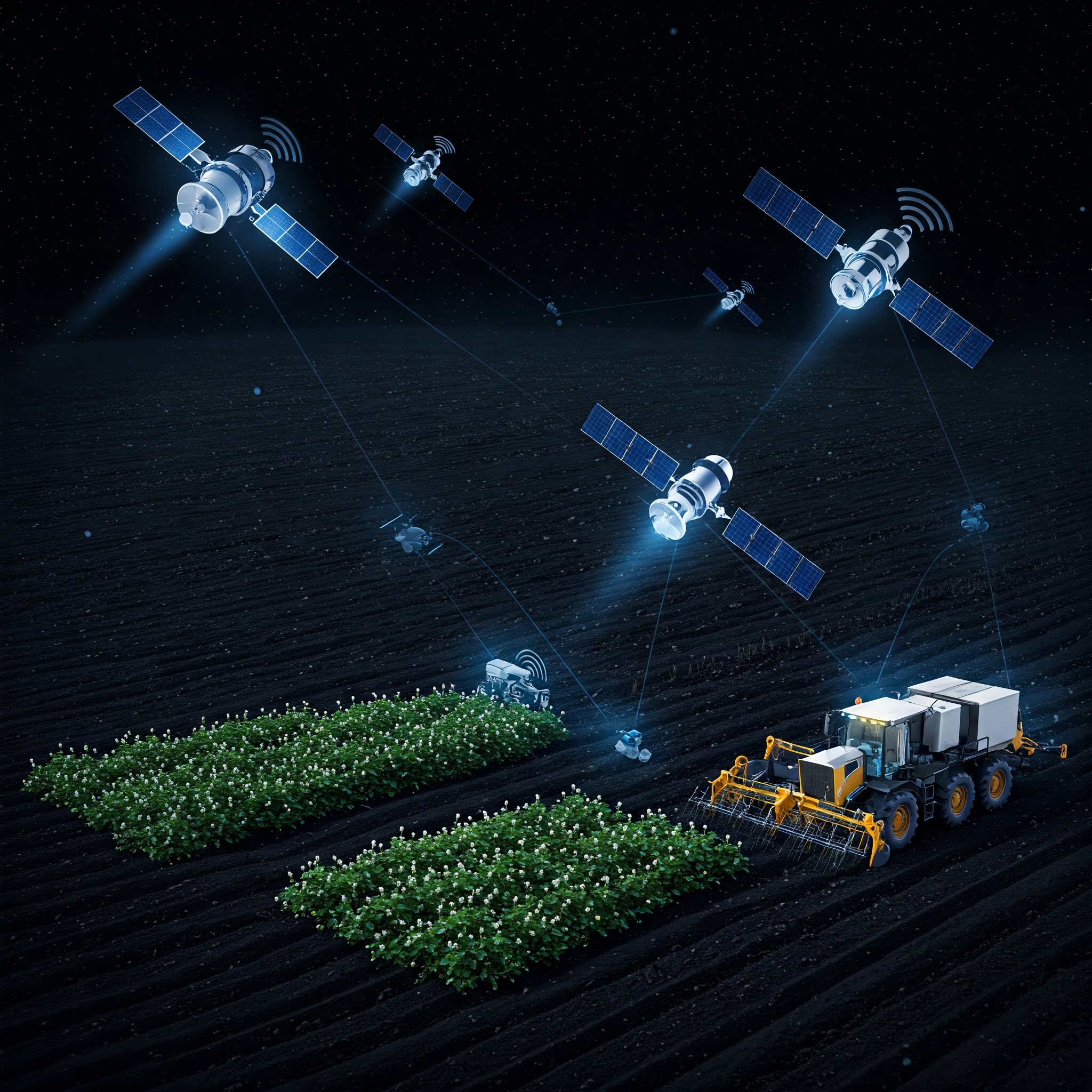
IV. The Power of Synergy: Integrated Satellite Applications:
The true potential of satellite technology is often realized when its communication and Earth observation capabilities are combined and leveraged in an integrated manner. Consider these examples:
- Real-time Field Intelligence: Satellite communication networks can facilitate the near real-time transmission of data from in-field sensors, drones, and other IoT devices to central processing platforms. This data can then be fused with concurrently acquired satellite imagery to provide farmers with a comprehensive and up-to-date understanding of their crops and environmental conditions, enabling immediate adjustments to management practices.
- Coordinated Disaster Response: During natural disasters, Earth observation satellites provide critical situational awareness by capturing imagery of affected agricultural areas and damaged communication infrastructure. Simultaneously, satellite communication networks ensure vital connectivity for emergency responders, enabling efficient coordination of relief efforts and communication with affected communities.
- Towards Sustainable Practices: Integrated satellite data can be used to monitor deforestation related to agricultural expansion, track water pollution from agricultural runoff, and assess the impact of climate change on agricultural productivity. This information supports the development and implementation of more sustainable farming practices and policies.
V. Navigating the Challenges, Embracing the Future:
Despite its remarkable contributions, the widespread adoption and continued advancement of satellite technology face several hurdles:
- The Cost Factor: The development, launch, and operation of satellites, as well as the acquisition and processing of satellite data, can represent a significant financial investment, potentially limiting accessibility for smaller organizations and developing nations.
- Data Overload and Accessibility: While the volume of available satellite data is constantly growing, ensuring user-friendly access, developing efficient processing methodologies, and providing intuitive analytical tools remain critical challenges.
- The Need for Expertise: Effectively harnessing the power of satellite technology requires specialized knowledge and skills in areas such as remote sensing, geographic information systems (GIS), data science, and satellite communication systems.
- Establishing Clear Regulations: Robust and consistent regulatory frameworks are essential for governing the use of satellite technology, addressing issues such as radio spectrum allocation, data privacy, and promoting responsible data sharing practices.
- Seamless Integration: Successfully integrating satellite-based solutions with existing terrestrial infrastructure, agricultural machinery, and established farming practices is crucial for maximizing their practical impact and ensuring widespread adoption.
Looking ahead, the future of satellite technology in communication and agriculture is brimming with exciting possibilities, fueled by:
- The Rise of SmallSats: The emergence of smaller, more cost-effective satellites and their deployment in large constellations is revolutionizing the industry. These “SmallSats” offer increased revisit frequencies for Earth observation, lower latency for communication, and improved global coverage.
- Enhanced Sensing Capabilities: Advancements in sensor technology are leading to the availability of hyperspectral imagery, capturing data across hundreds of narrow spectral bands to provide more detailed spectral signatures of vegetation and soil, and very high-resolution imagery, offering unprecedented spatial detail.
- The Power of Artificial Intelligence: Artificial intelligence (AI) and machine learning (ML) algorithms are becoming increasingly integral to processing and analyzing the vast datasets generated by satellites, enabling automated feature extraction, pattern recognition, and predictive modeling for agricultural and communication applications.
- Democratizing Access with Cloud Platforms: Cloud computing platforms are making satellite data and processing tools more accessible to a wider range of users, reducing the need for significant upfront investment in hardware and software.
- The Connected Farm: IoT Integration: The convergence of satellite communication with the Internet of Things (IoT) devices deployed in agricultural fields promises to create highly interconnected and data-rich farming environments, enabling real-time monitoring of environmental conditions, crop health, and livestock behavior.
VI. Conclusion: A Cosmic Partnership for a Connected and Cultivated Future:
Satellite technology has transcended its initial perception as a futuristic novelty to become a fundamental pillar of our interconnected and increasingly data-driven world. In communication, it continues to bridge geographical divides and empower global interaction. In agriculture, it provides invaluable insights for optimizing resource use, enhancing productivity, and promoting sustainable practices. As we continue to innovate and overcome existing challenges, the silent sentinels orbiting above us will undoubtedly play an even more crucial role in shaping a future where communication is seamless, and the cultivation of our land is guided by cosmic wisdom, ensuring a more connected, efficient, and sustainable world for all.