Introduction
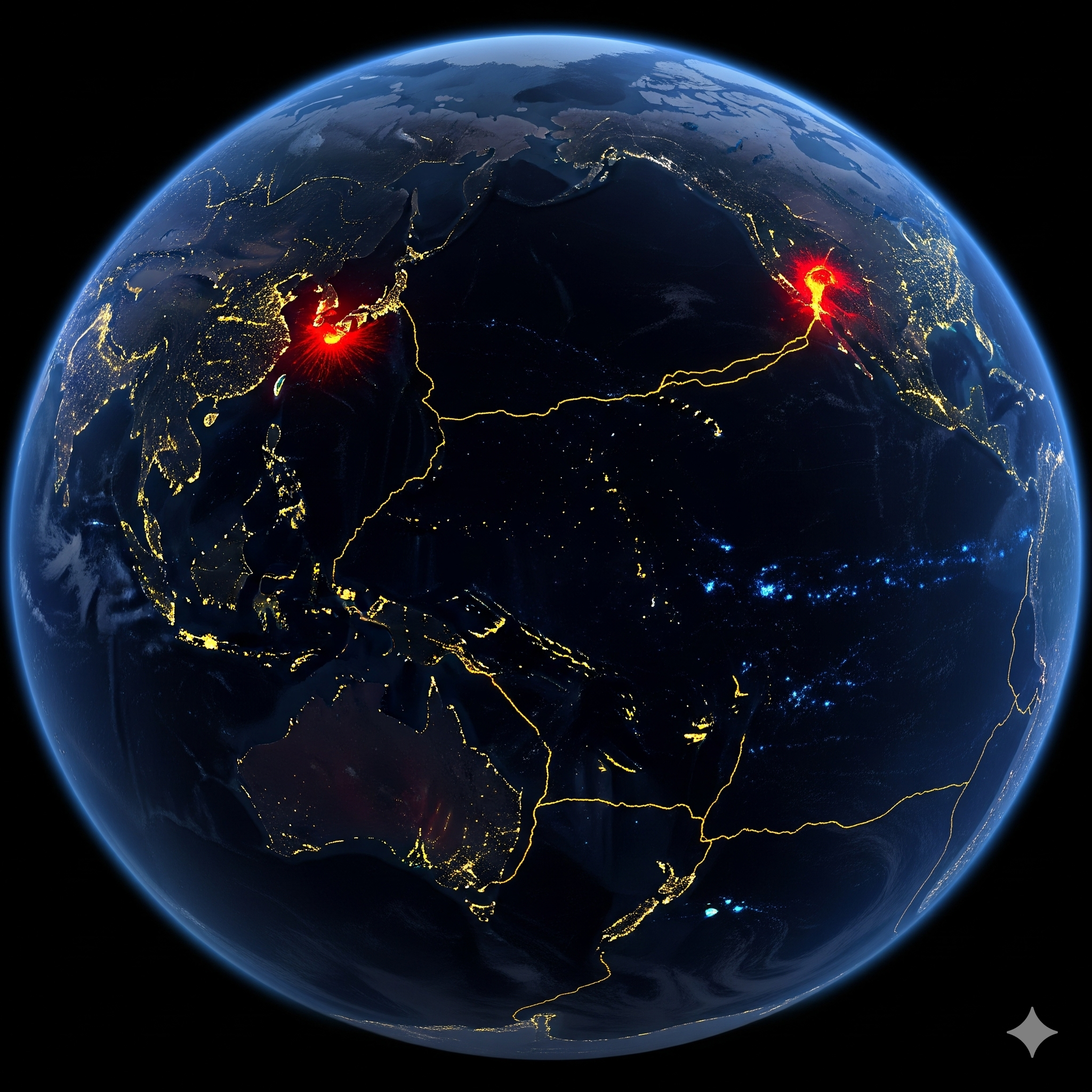
The Earth’s lithosphere is an intricate network of tectonic plates, which interact with one another through processes like subduction, collision, divergence, and transform movements. Among these regions, the Circum-Pacific Zone, often referred to as the “Pacific Ring of Fire”, is one of the most geologically active belts on Earth. Stretching for nearly 40,000 kilometers around the margins of the Pacific Ocean, it is characterized by intense seismicity, frequent volcanic eruptions, mountain-building processes, ocean trench formation, and large-scale tectonic activity.
The Circum-Pacific Zone is not just a geological phenomenon but also a major determinant of human-environment interaction, as a significant population resides along its boundaries. This region provides an excellent laboratory for understanding plate tectonics, volcanism, earthquakes, and the evolution of Earth’s crustal features.
This essay discusses the geophysical characteristics of the Circum-Pacific Zone in detail, including its tectonic setting, seismic activity, volcanism, mountain building, oceanic features, mineral resources, and environmental implications.
Geographical Extent of the Circum-Pacific Zone
The Circum-Pacific Zone forms an almost continuous horseshoe-shaped belt around the Pacific Ocean, spanning four continents and multiple island chains. Its boundaries encompass:
- Western Pacific Margins: Japan, Taiwan, Philippines, Papua New Guinea, Indonesia.
- Eastern Pacific Margins: Western coasts of North America (Alaska, USA, Mexico) and South America (Chile, Peru).
- Southern Pacific Margins: New Zealand, Tonga, and other island arcs.
- Northern Pacific Margins: Kamchatka Peninsula, Aleutian Islands, Kuril Islands.
In total, it traverses 25 countries and overlaps both continental and oceanic crusts.
Tectonic Framework of the Circum-Pacific Zone
1. Plate Boundaries
The geophysical nature of the Circum-Pacific Zone is primarily shaped by the interactions of major and minor tectonic plates, including:
- Pacific Plate – largest oceanic plate.
- Nazca Plate – subducting beneath South America.
- Cocos Plate – subducting beneath Central America.
- Juan de Fuca Plate – subducting beneath western North America.
- Philippine Plate – subducting beneath East Asia.
- Indo-Australian Plate – colliding and subducting in the South Pacific.
These plates are primarily involved in convergent boundaries, where oceanic plates subduct beneath continental or other oceanic plates.
2. Subduction Zones
The subduction process is central to the geophysical character of this region. Subduction occurs where a dense oceanic plate sinks beneath a less dense continental or oceanic plate, creating deep-sea trenches and volcanic arcs. Examples:
- Peru-Chile Trench (Nazca plate beneath South America).
- Mariana Trench (Pacific plate beneath Philippine plate).
- Japan Trench (Pacific plate beneath Eurasian plate).
3. Transform and Divergent Faults
While convergence dominates, the Circum-Pacific Zone also contains:
- Transform faults (e.g., San Andreas Fault in California).
- Back-arc basins and spreading centers (e.g., Mariana back-arc basin).
Together, these tectonic interactions explain the intense geophysical dynamism of the region.
Seismic Characteristics
1. Earthquake Distribution
Nearly 75% of the world’s earthquakes occur in the Circum-Pacific Zone. Major seismic zones include:
- Japan and Kuril Islands – epicenter of megaquakes.
- Alaska and Aleutians – frequent magnitude 7+ earthquakes.
- Andean Subduction Zone – site of 1960 Chile earthquake (M 9.5, strongest recorded).
- California – characterized by shallow-focus earthquakes along transform faults.
2. Earthquake Types
- Shallow-focus earthquakes (<70 km): Common near transform and divergent boundaries.
- Intermediate-focus earthquakes (70–300 km): Found along inclined subducting plates.
- Deep-focus earthquakes (300–700 km): Characteristic of Wadati-Benioff zones.
3. Tsunami Generation
Submarine earthquakes along trenches often displace large volumes of water, generating tsunamis.
- 2004 Indian Ocean tsunami (though outside Pacific, caused by similar tectonics).
- 2011 Tohoku Earthquake (Japan) produced devastating tsunami waves.
Volcanic Characteristics
1. Distribution of Volcanoes
The Ring of Fire hosts more than 450 active volcanoes, accounting for about 75% of the world’s active volcanoes.
- Island Arcs: Japan, Philippines, Indonesia, Aleutians.
- Continental Margins: Andes, Cascades (U.S.).
2. Types of Volcanoes
- Stratovolcanoes (Composite): Mount Fuji (Japan), Mount St. Helens (USA).
- Caldera volcanoes: Krakatoa (Indonesia).
- Island arc volcanoes: Mariana Islands, Tonga.
3. Volcanic Hazards
- Lava flows, pyroclastic flows, ash fall.
- Secondary impacts: climate cooling due to volcanic aerosols (e.g., 1991 Mount Pinatubo eruption).
Mountain Building and Orogenesis
1. Andes Mountains
Formed by the subduction of the Nazca Plate beneath the South American Plate. Characterized by:
- Folded sedimentary rocks.
- Active volcanic belts.
- Frequent crustal uplift.
2. North American Cordillera
The Rockies, Sierra Nevada, and Cascades were uplifted by interactions of Pacific, Juan de Fuca, and North American Plates.
3. Island Arc Systems
Chains like Japan, Philippines, and Aleutians represent volcanic arcs formed by oceanic-oceanic convergence.
Oceanic Features
1. Trenches
The Circum-Pacific Zone contains the deepest oceanic trenches:
- Mariana Trench (11,034 m, deepest point on Earth).
- Peru-Chile Trench.
- Japan Trench.
2. Ridges and Basins
Back-arc spreading creates new basins (e.g., Mariana Basin).
3. Seamounts and Guyots
Underwater volcanic mountains dot the Pacific floor, some later forming islands.
Geothermal and Mineral Resources
The geophysical processes have endowed the region with rich resources:
- Minerals: Copper, gold, silver in the Andes; nickel in Philippines.
- Energy: Geothermal energy from volcanic systems (e.g., Iceland, Philippines, Japan).
- Hydrocarbons: Sedimentary basins along continental margins contain oil and gas deposits.
Environmental and Societal Implications
1. Natural Hazards
- Frequent earthquakes and tsunamis pose risks to densely populated coastal zones.
- Volcanic eruptions disrupt agriculture, aviation, and climate.
2. Human Adaptation
- Japan and Chile have advanced earthquake-resistant infrastructure.
- Pacific Tsunami Warning System (PTWS) monitors hazards.
3. Ecological Effects
- Volcanic eruptions enrich soils (Andes, Java), supporting agriculture.
- Hydrothermal vents support unique ecosystems.
Geophysical Theories Linked with the Circum-Pacific Zone
1. Plate Tectonic Theory
Explains subduction, volcanism, and seismicity as outcomes of plate movements.
2. Seafloor Spreading
Back-arc basin formation supports the mechanism of new crust creation.
3. Elastic Rebound Theory
Explains release of accumulated stress in earthquakes (e.g., San Andreas Fault).
Case Studies of Major Events
- 1960 Chile Earthquake (M 9.5): Largest ever recorded.
- 1980 Mount St. Helens eruption: Example of composite volcano.
- 2011 Tohoku Earthquake & Tsunami: Devastated Japan, triggered Fukushima nuclear disaster.
- 1991 Mount Pinatubo eruption (Philippines): Major climatic impact.
Future Geophysical Trends
- Increasing seismic monitoring and predictive models may reduce disaster risks.
- Climate change may influence volcanic and seismic activity indirectly (via glacial unloading).
- Plate motions indicate continued subduction and volcanic activity for millions of years.
Conclusion
The Circum-Pacific Zone is a unique geophysical laboratory where the processes of plate tectonics are vividly expressed. It contains the world’s most powerful earthquakes, deepest oceanic trenches, and most active volcanoes. The region illustrates the dynamic nature of the Earth’s lithosphere, driven by subduction and plate interactions. While it poses immense natural hazards, it also offers rich resources, fertile lands, and insights into Earth’s geological history.
For students of geography and earth sciences, understanding the Circum-Pacific Zone is crucial to comprehending the broader framework of tectonic activity and the interplay between natural processes and human society.