Introduction
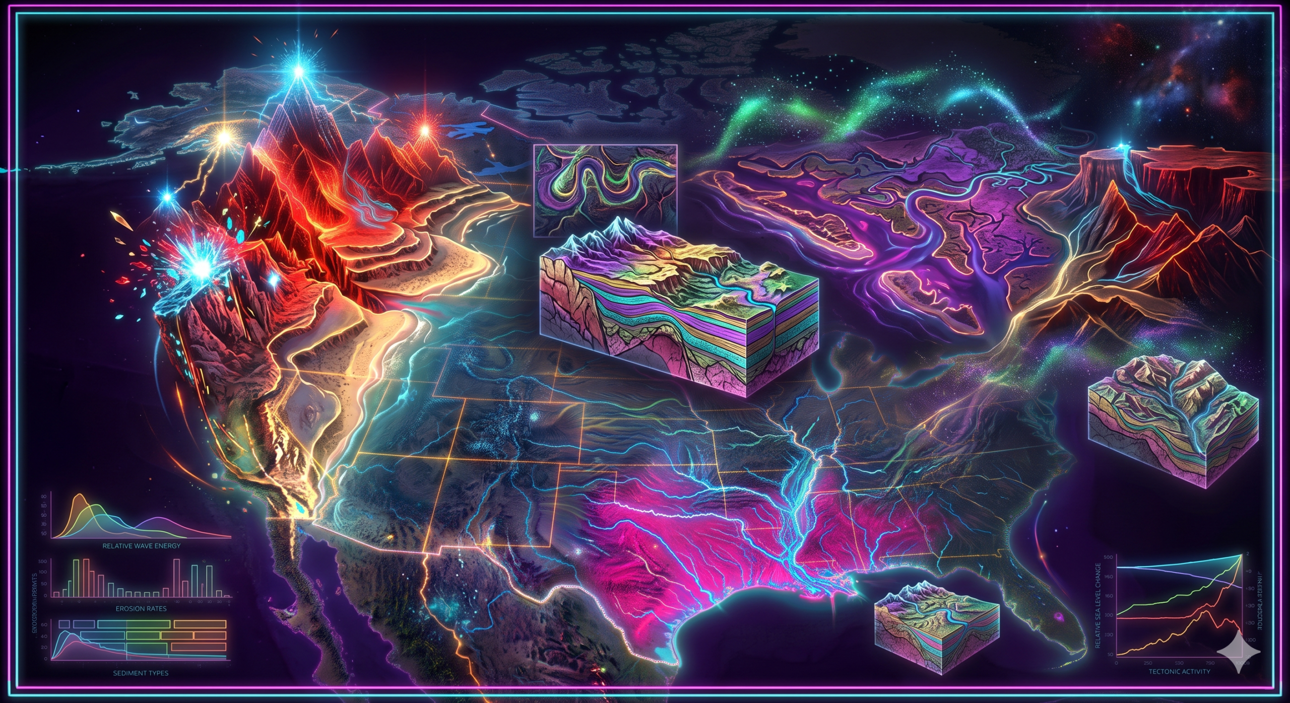
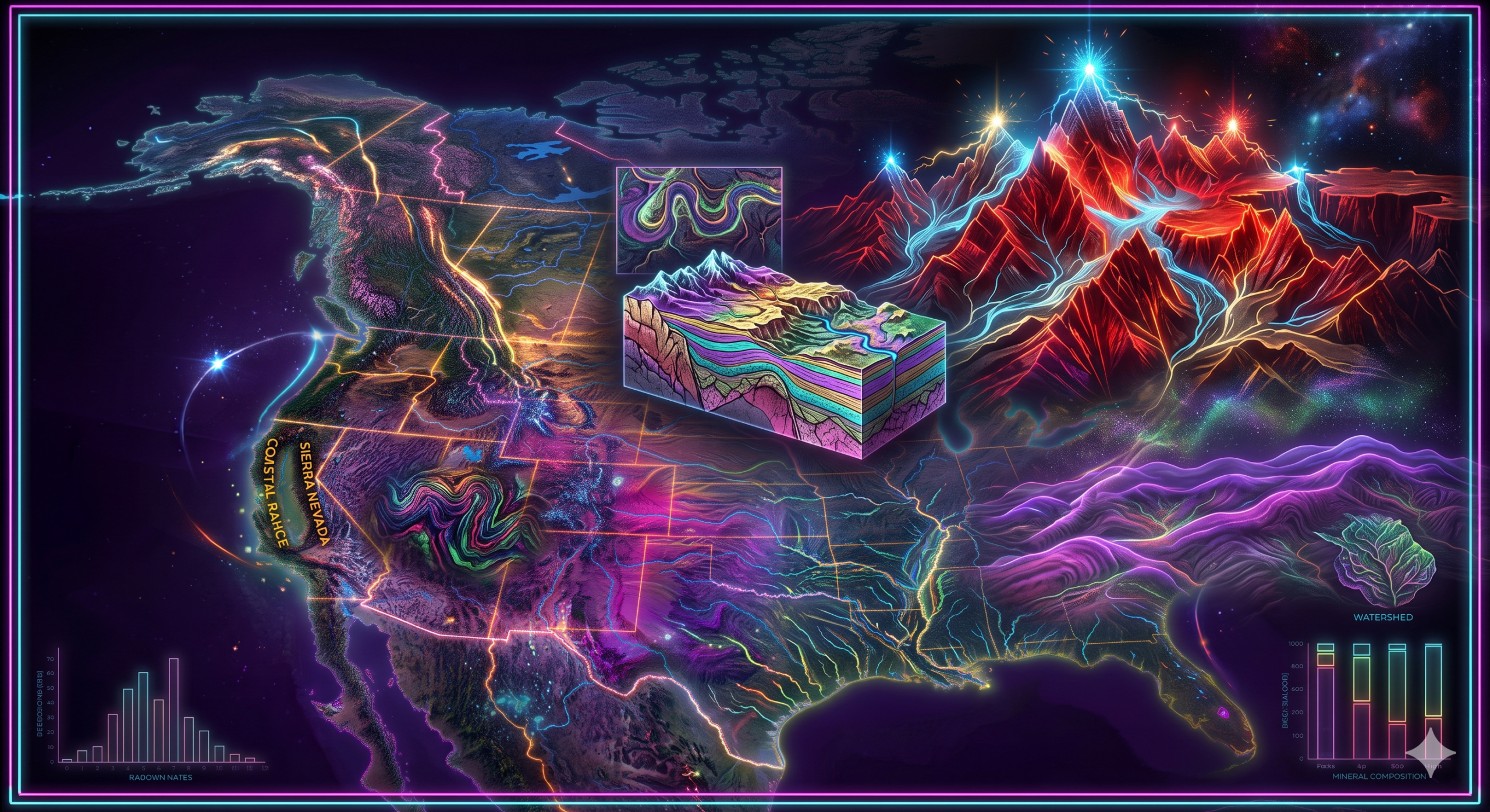
Rivers are among the most powerful natural agents responsible for shaping the Earth’s surface. Through the continuous processes of erosion, transportation, and deposition, rivers modify landscapes over thousands and millions of years, creating a wide variety of landforms. In North America, the Mississippi River and the Colorado River are two of the most significant river systems because of their enormous influence on the continent’s geomorphic evolution. Although these rivers flow through different climatic regions and geological settings, both have transformed the physical landscape in remarkable ways.
The Mississippi River has developed one of the world’s largest drainage basins and has created extensive floodplains, natural levees, meanders, oxbow lakes, and the vast Mississippi Delta. The Colorado River, flowing across the arid southwestern United States and northern Mexico, is famous for carving the spectacular Grand Canyon and numerous deep gorges through the Colorado Plateau. Together, these rivers demonstrate how fluvial processes shape mountains, plains, plateaus, valleys, and coastal regions.
Studying the role of these rivers provides valuable insight into landscape evolution, sediment transport, tectonic interactions, environmental change, and the long-term development of North America’s physical geography.
Rivers as Agents of Geomorphic Change
Rivers constantly reshape the Earth’s surface through three fundamental geomorphic processes:
1. Erosion
Erosion involves the removal of rock and soil from the land surface through:
- Hydraulic action
- Abrasion
- Attrition
- Solution (chemical erosion)
These processes deepen valleys, widen channels, and create distinctive landforms.
2. Transportation
After erosion, rivers transport sediments downstream.
Materials are moved as:
- Dissolved load
- Suspended load
- Bed load
- Saltation
The amount of sediment transported depends on river velocity and discharge.
3. Deposition
When river velocity decreases, sediments are deposited.
Deposition forms:
- Floodplains
- Natural levees
- Deltas
- Alluvial fans
- River terraces
- Sandbars
These depositional features contribute significantly to landscape evolution.
Overview of the Mississippi River
The Mississippi River is the second-longest river in North America after the Missouri River when measured as a combined river system.
Key Facts
- Length: Approximately 3,766 kilometers (2,340 miles)
- Source: Lake Itasca, Minnesota
- Mouth: Gulf of Mexico
- Drainage Basin: About 3.2 million square kilometers
- Major Tributaries:
- Missouri River
- Ohio River
- Arkansas River
- Red River
- Tennessee River
The Mississippi drains nearly 40% of the contiguous United States, making it one of the world’s largest river systems.
Geomorphic Contributions of the Mississippi River
1. Development of Extensive Floodplains
One of the Mississippi River’s greatest geomorphic contributions is the creation of broad floodplains.
During floods, the river overflows its banks and deposits fine sediments.
These repeated deposits have produced:
- Fertile alluvial soils
- Flat landscapes
- Agricultural regions
The Mississippi floodplain is among the world’s most productive farming areas.
2. Formation of Meanders
As the river flows across low-gradient plains, lateral erosion creates large meanders.
Meanders continuously migrate due to:
- Outer-bank erosion
- Inner-bank deposition
This process reshapes the surrounding landscape.
3. Creation of Oxbow Lakes
When a meander loop is cut off during flooding, an oxbow lake forms.
These crescent-shaped lakes provide evidence of river channel migration and floodplain evolution.
4. Natural Levees
Floodwaters deposit coarse sediments close to the river channel.
Over time, natural levees develop along river banks.
These elevated ridges influence flood behavior and human settlement.
5. River Terraces
Changes in river level and climate have produced river terraces.
Terraces preserve former floodplain surfaces and record past environmental conditions.
6. Mississippi Delta Formation
One of the river’s greatest depositional achievements is the Mississippi Delta.
Over thousands of years, enormous quantities of sediment have accumulated where the river enters the Gulf of Mexico.
The delta contains:
- Marshes
- Wetlands
- Distributary channels
- Barrier islands
It is one of the world’s largest river deltas.
7. Sediment Redistribution
The Mississippi transports hundreds of millions of tons of sediment annually.
This sediment originates from:
- Rocky Mountains
- Great Plains
- Appalachian Mountains
- Interior Highlands
The river redistributes these materials across central North America.
Overview of the Colorado River
The Colorado River flows through the arid western United States and northwestern Mexico.
Key Facts
- Length: Approximately 2,330 kilometers (1,450 miles)
- Source: Rocky Mountains, Colorado
- Mouth: Gulf of California (although modern flow is often reduced before reaching the sea)
- Drainage Basin: About 637,000 square kilometers
Major tributaries include:
- Green River
- San Juan River
- Gunnison River
- Little Colorado River
Geomorphic Contributions of the Colorado River
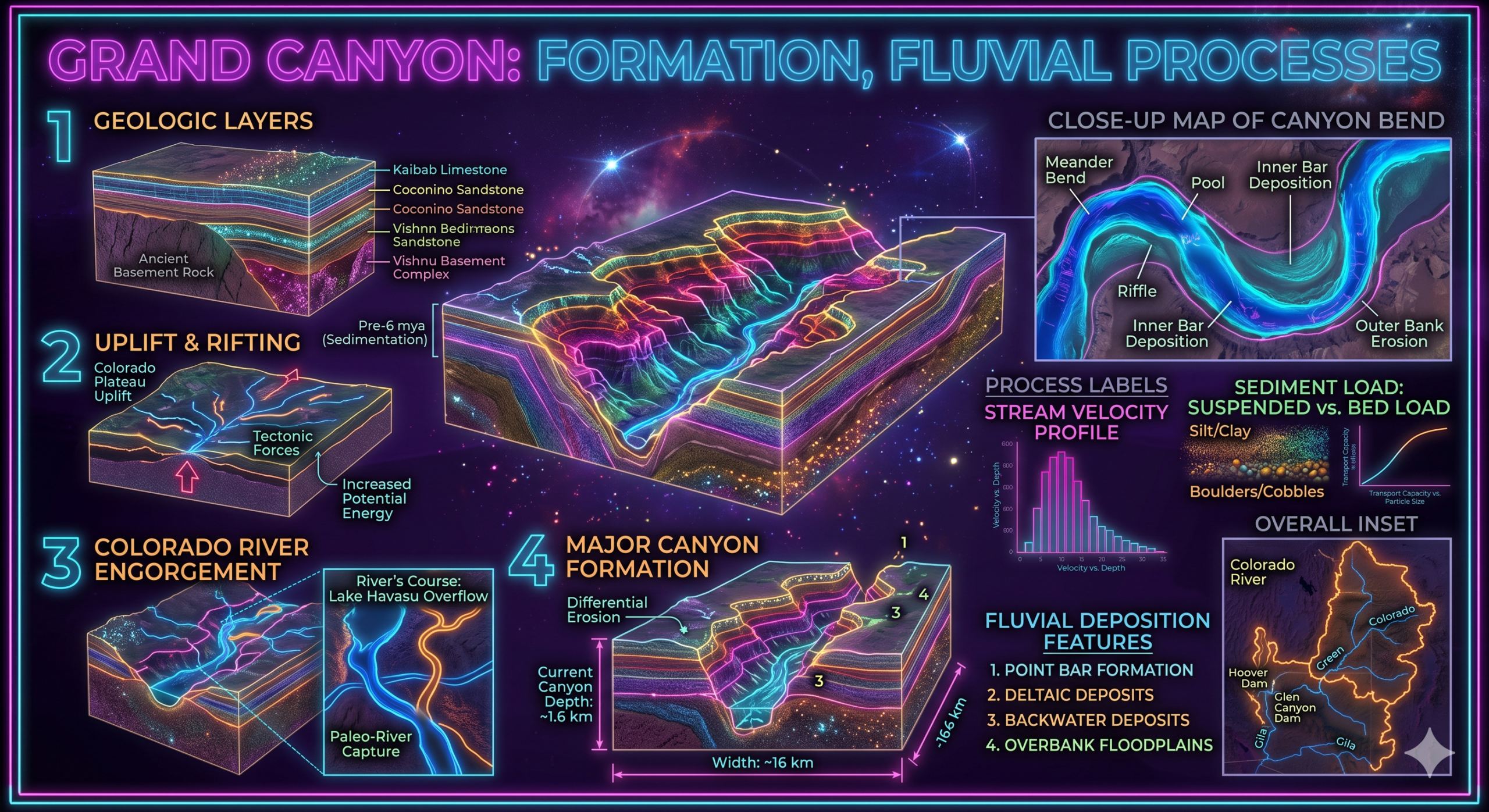
1. Formation of the Grand Canyon
The Grand Canyon represents the Colorado River’s greatest geomorphic achievement.
Over approximately 5–6 million years, the river has cut more than 1,800 meters into the Colorado Plateau.
This canyon demonstrates:
- Vertical erosion
- River incision
- Long-term landscape evolution
2. Canyon Development
Besides the Grand Canyon, the Colorado River has carved numerous additional canyons.
Examples include:
- Marble Canyon
- Glen Canyon
- Black Canyon
These canyons reflect continuous fluvial erosion.
3. River Incision
Regional uplift of the Colorado Plateau increased river gradients.
The Colorado River responded by cutting deeply into bedrock.
River incision remains one of the defining geomorphic processes in the region.
4. Transportation of Sediments
The Colorado transports:
- Sand
- Gravel
- Clay
- Silt
- Boulders
These sediments contribute to downstream depositional environments.
5. Formation of River Terraces
As erosion continued, older valley floors remained above the modern river.
These terraces record former river levels and climatic conditions.
6. Alluvial Fans
Where tributary streams emerge from steep valleys, they deposit sediments in fan-shaped deposits.
Alluvial fans are common throughout the Colorado River Basin.
7. Creation of Deep Gorges
Powerful erosion has produced steep-walled gorges throughout the basin.
These landforms illustrate the interaction between tectonic uplift and river erosion.
Comparison of the Mississippi and Colorado Rivers
Although both rivers are major geomorphic agents, they operate under different environmental conditions.
| Feature | Mississippi River | Colorado River |
|---|---|---|
| Climate | Humid | Semi-arid to arid |
| Dominant Process | Deposition | Erosion |
| Main Landforms | Floodplains, meanders, delta | Canyons, gorges, terraces |
| River Gradient | Gentle | Steep |
| Sediment Deposition | Extensive | Moderate |
| Valley Shape | Broad valleys | Deep narrow canyons |
| Tectonic Influence | Limited | Strong |
Combined Role in North America’s Geomorphic Evolution
Together, these rivers have transformed much of North America.
1. Landscape Evolution
Both rivers demonstrate how landscapes evolve through:
- Continuous erosion
- Sediment transport
- Deposition
- Valley development
2. Drainage Development
The Mississippi and Colorado Rivers organize vast drainage networks.
Their tributaries drain millions of square kilometers.
These drainage systems strongly influence regional geomorphology.
3. Soil Formation
River sediments produce fertile alluvial soils.
These soils support:
- Agriculture
- Grasslands
- Wetlands
- Forests
4. Valley Development
Both rivers have created valleys suited for:
- Human settlement
- Agriculture
- Transportation
However, valley shapes differ due to varying geological conditions.
5. Delta and Coastal Evolution
The Mississippi River continues building coastal wetlands through sediment deposition.
Although modern dams have reduced sediment supply, delta formation remains an important geomorphic process.
6. Canyon Evolution
The Colorado River demonstrates how rivers can cut through resistant bedrock over millions of years.
Its canyon system provides exceptional evidence of fluvial erosion.
7. Exposure of Geological History
River erosion exposes ancient rock formations.
These exposures allow scientists to study:
- Sedimentary layers
- Fossils
- Structural geology
- Geological history
The Grand Canyon is one of the world’s finest geological records.
8. Influence on Ecosystems
River valleys support diverse ecosystems, including:
- Wetlands
- Riparian forests
- Grasslands
- Freshwater habitats
These environments depend on river processes.
9. Natural Resource Distribution
River systems influence the distribution of:
- Groundwater
- Sand and gravel
- Fertile soils
- Fisheries
These resources support regional economies.
10. Human Settlement
Many major cities developed along these rivers.
The Mississippi supports cities such as:
- Minneapolis
- St. Louis
- Memphis
- New Orleans
The Colorado provides water to cities including:
- Denver (headwaters region)
- Las Vegas (via diversions)
- Phoenix
- Los Angeles (through water transfer systems)
Modern Human Influences
Human activities have modified both rivers.
Examples include:
- Dams
- Levees
- Reservoirs
- Irrigation
- Navigation projects
- Channelization
These modifications affect natural geomorphic processes by reducing sediment transport and altering river flow.
Environmental Challenges
Both river systems face significant environmental issues.
Mississippi River
- Flooding
- Wetland loss
- Delta subsidence
- Agricultural pollution
- Sediment reduction
Colorado River
- Water shortages
- Dam construction
- Reduced flow
- Climate change
- Drought
- Declining reservoirs
These challenges influence future landscape evolution.
Scientific Importance
The Mississippi and Colorado Rivers are studied extensively using:
- Satellite imagery
- Remote sensing
- Geographic Information Systems (GIS)
- LiDAR
- Sediment analysis
- Hydrological modeling
- Radiometric dating
These techniques improve understanding of fluvial geomorphology and environmental change.
Importance in Geomorphology
The Mississippi and Colorado Rivers are classic examples of how rivers shape continents.
They illustrate:
- Fluvial erosion
- River incision
- Sediment transport
- Floodplain development
- Delta formation
- Canyon formation
- Landscape evolution
- Interaction between tectonics and river systems
Together, they provide outstanding natural laboratories for studying Earth’s surface processes.
Conclusion
The Mississippi and Colorado Rivers have played fundamental roles in the geomorphic evolution of North America through the continuous processes of erosion, transportation, and deposition. While the Mississippi River has shaped extensive floodplains, meanders, oxbow lakes, natural levees, and one of the world’s largest deltas, the Colorado River has carved spectacular canyons, deep gorges, river terraces, and steep valleys across the uplifted Colorado Plateau. Their contrasting landscapes demonstrate how differences in climate, geology, topography, and tectonic activity influence river behavior and landform development.
Beyond their physical impact, these rivers have contributed to fertile agricultural lands, freshwater resources, biodiversity, transportation, and human settlement. They also provide invaluable evidence of long-term landscape evolution and continue to serve as key subjects in the study of geomorphology, physical geography, and Earth science. Understanding the role of these rivers enhances our appreciation of the dynamic processes that have shaped North America’s diverse landscapes over millions of years.