Introduction
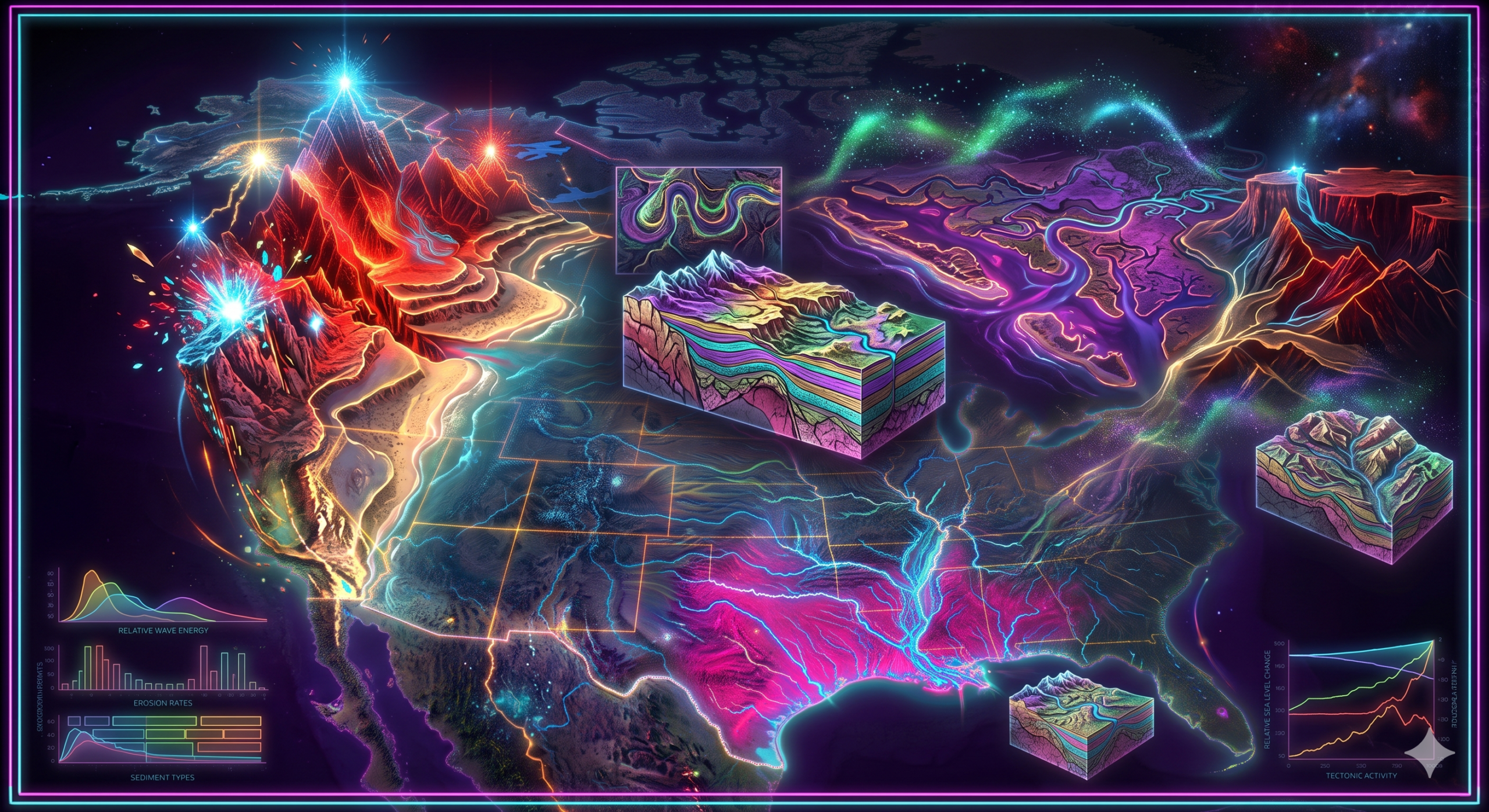
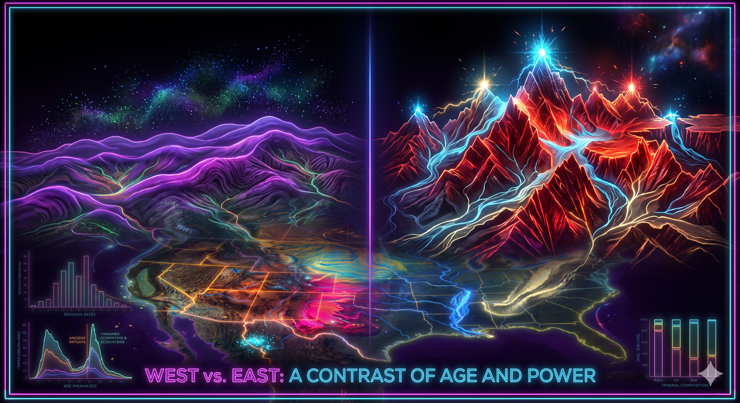
Western North America is one of the most geologically active regions on Earth. Its dramatic landscapes—including towering mountain ranges, deep valleys, volcanic peaks, plateaus, rift basins, fault scarps, and coastal cliffs—have been shaped primarily by tectonic activity, earthquakes, and volcanism over millions of years. These powerful endogenic (internal) forces continue to modify the region, making it an outstanding natural laboratory for studying geomorphology, plate tectonics, and landscape evolution.
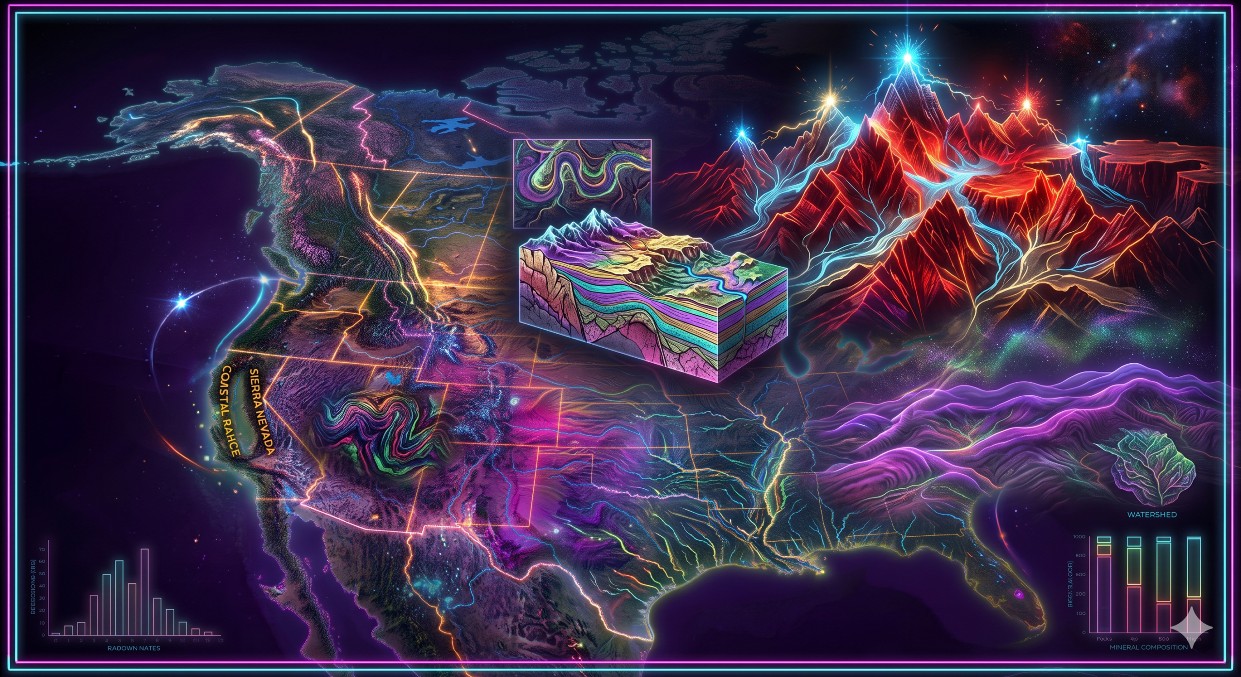
The western margin of North America lies along the Pacific Ring of Fire, a zone characterized by intense tectonic interactions, frequent earthquakes, active volcanoes, and mountain-building processes. The movement of the Pacific Plate, North American Plate, Juan de Fuca Plate, Cocos Plate, and several smaller tectonic plates has created some of the continent’s most spectacular landforms, including the Rocky Mountains, Cascade Range, Sierra Nevada, Coast Mountains, Basin and Range Province, and numerous volcanic plateaus.
Earthquakes, crustal uplift, faulting, folding, and volcanic eruptions have not only produced new landforms but have also continuously reshaped existing landscapes. Understanding these processes is essential for explaining the physical geography of western North America and for assessing geological hazards and environmental change.
Understanding Endogenic Processes
Endogenic processes originate within the Earth’s interior and derive their energy from internal heat and tectonic forces.
The three major endogenic processes influencing western North America are:
- Plate tectonics
- Earthquakes
- Volcanism
Together, these processes are responsible for mountain building, crustal deformation, volcanic landforms, and seismic activity.
Tectonic Setting of Western North America
Western North America is located along the boundary of several tectonic plates.
The major plates include:
- North American Plate
- Pacific Plate
- Juan de Fuca Plate
- Cocos Plate
- Explorer Plate
Their interactions involve:
- Subduction
- Transform faulting
- Divergence
- Crustal extension
These interactions have shaped the region over tens of millions of years.
Plate Boundaries in Western North America
1. Transform Boundary
The San Andreas Fault in California marks the transform boundary between the Pacific Plate and the North American Plate.
Characteristics include:
- Horizontal movement
- Frequent earthquakes
- Fault valleys
- Offset streams
2. Convergent Boundary
Along the Pacific Northwest, the Juan de Fuca Plate subducts beneath the North American Plate.
This subduction forms:
- Cascade volcanic arc
- Deep earthquakes
- Mountain uplift
3. Divergent and Extensional Regions
The Basin and Range Province experiences crustal extension.
This produces:
- Normal faults
- Rift valleys
- Horsts
- Grabens
Impact of Tectonic Activity on Geomorphology
Tectonic activity has profoundly influenced western North America’s landscape.
1. Mountain Building (Orogeny)
Mountain building is one of the most significant geomorphic consequences of tectonic activity.
Important mountain systems include:
- Rocky Mountains
- Sierra Nevada
- Cascade Range
- Coast Mountains
- Alaska Range
These mountains formed through:
- Plate convergence
- Crustal uplift
- Folding
- Faulting
They dominate the western landscape.
2. Formation of the Rocky Mountains
The Rocky Mountains formed mainly during the Laramide Orogeny (approximately 80–55 million years ago).
The shallow-angle subduction of the Farallon Plate beneath the North American Plate caused:
- Crustal compression
- Uplift
- Folding
- Basement faulting
The result was the formation of one of North America’s greatest mountain systems.
3. Development of the Basin and Range Province
The Basin and Range Province extends across Nevada and neighboring states.
Its distinctive topography consists of alternating:
- Mountain ranges (horsts)
- Valleys (grabens)
These features formed through crustal extension and normal faulting.
4. Formation of Fault Scarps
Movement along faults creates steep slopes called fault scarps.
These scarps represent direct evidence of crustal displacement.
Many remain visible across California, Nevada, Utah, and Arizona.
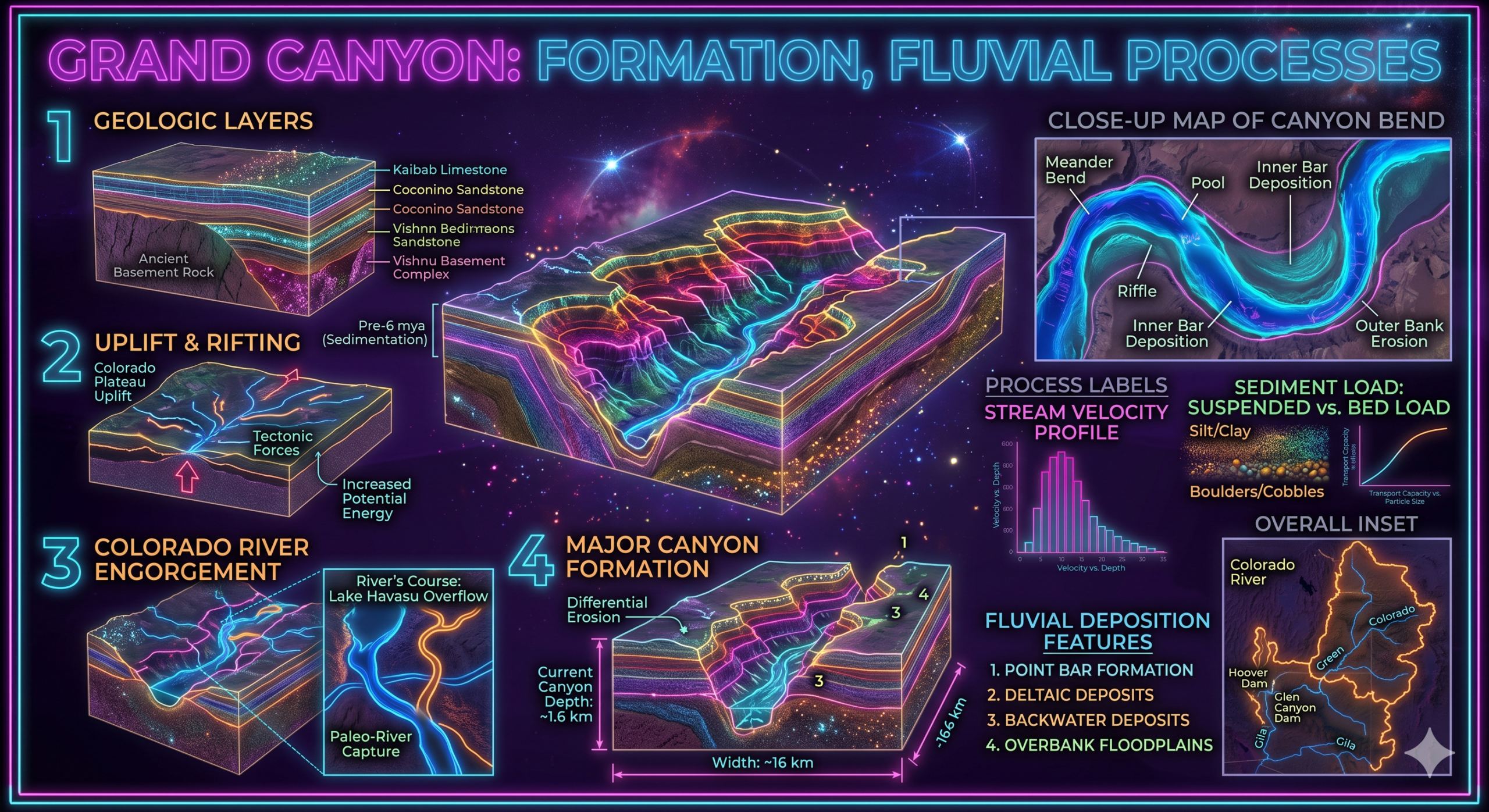
5. Uplift of Plateaus
The Colorado Plateau was uplifted by tectonic forces without extensive folding.
Its uplift increased river gradients, allowing the Colorado River to carve the Grand Canyon.
Impact of Earthquakes on Geomorphology
Earthquakes occur when accumulated tectonic stress is suddenly released.
Western North America experiences thousands of earthquakes annually.
1. Surface Faulting
Major earthquakes produce visible fractures in the Earth’s surface.
Surface faulting may create:
- Fault scarps
- Offset roads
- Displaced rivers
- Linear valleys
2. Valley Formation
Repeated fault movement produces structural valleys.
Examples include:
- Owens Valley
- Death Valley
These valleys continue evolving through tectonic activity.
3. Ground Deformation
Earthquakes cause:
- Land uplift
- Land subsidence
- Tilting
- Cracking
These changes modify drainage systems and local topography.
4. Landslides
Strong ground shaking often triggers landslides.
Mountainous regions are particularly susceptible.
Landslides:
- Reshape slopes
- Block rivers
- Create temporary lakes
5. River Course Changes
Earthquake-induced uplift and landslides may alter river channels.
Drainage patterns may change significantly after major seismic events.
6. Coastal Changes
Earthquakes along coastal regions may produce:
- Coastal uplift
- Coastal subsidence
- Tsunamis
- Shoreline modification
These changes are particularly important along Alaska and the Pacific Northwest.
Impact of Volcanism on Geomorphology
Volcanism has created many of western North America’s most recognizable landforms.
1. Formation of Volcanic Mountains
The Cascade Range contains numerous stratovolcanoes, including:
- Mount St. Helens
- Mount Rainier
- Mount Hood
- Mount Shasta
- Lassen Peak
These mountains formed through repeated volcanic eruptions.
2. Lava Plateaus
Extensive lava flows created volcanic plateaus.
Examples include:
- Columbia Plateau
- Snake River Plain
Successive basalt eruptions produced thick volcanic rock layers.
3. Calderas
Large volcanic eruptions sometimes collapse into giant depressions called calderas.
Examples include:
- Crater Lake (Oregon)
- Long Valley Caldera (California)
4. Volcanic Cones
Different eruption styles create:
- Composite cones
- Shield volcanoes
- Cinder cones
These landforms dominate many western volcanic regions.
5. Lava Domes
Viscous lava may accumulate near volcanic vents, forming lava domes.
Several occur within the Cascade volcanic arc.
6. Volcanic Ash Deposits
Explosive eruptions distribute volcanic ash across large areas.
Ash contributes to:
- Fertile soils
- Landscape modification
- River sedimentation
Interaction Between Tectonics and Fluvial Processes
Tectonic uplift strongly influences river erosion.
Examples include:
- Grand Canyon
- Columbia River Gorge
- Snake River Canyon
As uplift raises the land, rivers increase vertical erosion, producing deep valleys and canyons.
Interaction Between Glaciation and Tectonics
Mountain uplift created high elevations where glaciers developed during the Pleistocene Ice Age.
Glaciers produced:
- U-shaped valleys
- Cirques
- Arêtes
- Horns
- Fjords
Thus, tectonic uplift indirectly enhanced glacial geomorphology.
Major Geomorphic Regions Created by Tectonic Activity
Western North America contains several distinctive geomorphic provinces.
Rocky Mountains
Young fold mountains characterized by rugged peaks and deep valleys.
Cascade Range
Volcanic mountain chain formed by subduction.
Sierra Nevada
Fault-block mountain range uplifted along normal faults.
Basin and Range Province
Alternating fault-block mountains and basins produced by crustal extension.
Colorado Plateau
Broad uplifted plateau deeply dissected by rivers.
Coast Mountains
Mountain range shaped by tectonic uplift, glaciation, and erosion.
Geomorphological Significance
Tectonic activity, earthquakes, and volcanism have produced:
- Mountain systems
- Rift valleys
- Plateaus
- Volcanic cones
- Calderas
- Fault scarps
- Lava plateaus
- Structural basins
- Deep canyons
These landforms demonstrate the dynamic nature of Earth’s crust.
Environmental and Economic Importance
The geomorphic features of western North America support numerous human activities.
Natural Resources
The region contains:
- Gold
- Copper
- Silver
- Iron
- Geothermal energy
- Building stone
Agriculture
Volcanic soils are highly fertile.
Important crops include:
- Grapes
- Fruits
- Wheat
- Potatoes
Hydroelectric Power
Mountain rivers support major hydroelectric projects.
Tourism
Visitors are attracted to:
- National parks
- Volcanoes
- Mountain ranges
- Canyons
- Ski resorts
Tourism contributes significantly to regional economies.
Geological Hazards
Despite their benefits, tectonic processes create serious hazards.
Major hazards include:
- Earthquakes
- Volcanic eruptions
- Tsunamis
- Landslides
- Ground rupture
- Ashfall
Monitoring these hazards helps reduce risks to communities.
Modern Techniques Used to Study Geomorphic Change
Scientists investigate western North America’s landscapes using:
- Satellite imagery
- Geographic Information Systems (GIS)
- Remote sensing
- LiDAR
- GPS measurements
- Seismographs
- Drone surveys
- Radiometric dating
These technologies improve understanding of active geomorphic processes.
Importance for Geomorphology
Western North America serves as one of the world’s finest natural laboratories for studying:
- Plate tectonics
- Mountain building
- Structural geomorphology
- Volcanic geomorphology
- Earthquake geomorphology
- Landscape evolution
- Active geological processes
The region demonstrates how Earth’s internal forces continually reshape continental landscapes.
Conclusion
Tectonic activity, earthquakes, and volcanism have profoundly influenced the geomorphology of western North America, creating one of the most dynamic and diverse landscapes on Earth. Plate interactions involving the North American, Pacific, Juan de Fuca, and other tectonic plates have produced towering mountain ranges, uplifted plateaus, fault-block valleys, volcanic arcs, lava plateaus, and deep structural basins. Earthquakes continue to reshape the landscape through faulting, uplift, subsidence, landslides, and changes in river systems, while volcanism has formed stratovolcanoes, calderas, lava domes, and extensive basalt plateaus.
These endogenic processes have also interacted with rivers, glaciers, and weathering to produce spectacular landforms such as the Grand Canyon, Columbia River Gorge, and glacial valleys of the Rocky Mountains and Alaska. Beyond their geomorphological significance, these features support biodiversity, agriculture, hydroelectric power, tourism, and mineral resources while also presenting challenges such as earthquakes, volcanic eruptions, and landslides. Understanding the impact of tectonic activity, earthquakes, and volcanism is therefore essential for interpreting the evolution of western North America’s physical landscape and for promoting effective environmental management and disaster preparedness.