Home » geomorphology
Western North America

Tectonics, Earthquakes, and Volcanism: Shaping the Landscapes of Western North America

Introduction Western North America is one of the most geologically active regions on Earth. Its dramatic landscapes—including towering mountain ranges, deep valleys, volcanic peaks, plateaus, rift basins, fault scarps, and coastal cliffs—have been shaped primarily by tectonic activity, earthquakes, and volcanism over millions of years. These powerful endogenic (internal) forces continue to modify the region,…


Read More
Mississippi River, Colorado River

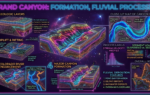
Geomorphic Evolution of North America: The Role of the Mississippi and Colorado Rivers

Introduction Rivers are among the most powerful natural agents responsible for shaping the Earth’s surface. Through the continuous processes of erosion, transportation, and deposition, rivers modify landscapes over thousands and millions of years, creating a wide variety of landforms. In North America, the Mississippi River and the Colorado River are two of the most significant…

Read More
Appalachian Mountains

Appalachian Mountains vs. Rocky Mountains: A Geomorphological Comparison

Introduction The Appalachian Mountains and the Rocky Mountains are two of the most important mountain systems in North America. Although both have played a major role in shaping the continent’s physical landscape, they differ significantly in their geological age, origin, structure, landforms, geomorphic processes, and environmental characteristics. These mountain ranges provide valuable evidence of Earth’s…

Read More
Great Plains, Great Plains Geomorphology

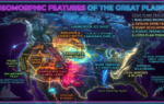
Main Geomorphic Features of the Great Plains, and How Were They Formed?

Introduction The Great Plains are one of the most extensive and significant physiographic regions of North America. Stretching from the Canadian provinces of Alberta, Saskatchewan, and Manitoba southward through the central United States to Texas and New Mexico, the Great Plains cover approximately 2.9 million square kilometers. This vast region lies immediately east of the…

Read More
Glaciation in North America

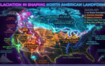
Role of Glaciation in Shaping the Landforms of North America

Introduction Glaciation has been one of the most powerful natural forces responsible for shaping the physical landscape of North America. Over the past 2.6 million years, during the Quaternary Period, repeated advances and retreats of massive glaciers transformed large parts of the continent. These glaciers carved mountains, widened valleys, created thousands of lakes, deposited fertile…

Read More
Rocky Mountains geomorphological significance

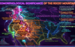
How Were the Rocky Mountains Formed? Discuss Their Geomorphological Significance

Introduction The Rocky Mountains are one of the most spectacular and geologically significant mountain systems in the world. Stretching for nearly 4,800 kilometers (about 3,000 miles) from northern British Columbia in Canada to New Mexico in the United States, the Rockies form the backbone of western North America. They pass through the Canadian provinces of…

Read More
Geomorphology, North America Geomorphology

What is Geomorphology, and Why is it Important in the Study of North America’s Physical Landscape?

Introduction Geomorphology is one of the most important branches of physical geography and Earth science. It focuses on the study of landforms, the processes responsible for their formation, and the continuous changes they undergo over geological time. Every mountain range, valley, river, desert, coastline, and plain visible on Earth’s surface has evolved through a combination…

Read More
pcs magazine

The Role of Plate Tectonics in the Formation of Different Landforms

Introduction Plate tectonics is a fundamental geological theory that explains the movement of Earth’s lithospheric plates and their interactions. This dynamic process shapes Earth’s surface, creating various landforms through mechanisms such as divergence, convergence, and transform motion. The movement of these plates leads to the formation of mountains, valleys, volcanoes, oceanic trenches, rift valleys, and…

Read More
pcs magazine

Landforms Formed by Wind Erosion and Deposition

Wind is one of the most powerful natural forces that shape the Earth’s surface, especially in arid and semi-arid regions. Wind erosion and deposition create a variety of unique landforms that contribute to the dynamic nature of desert landscapes. These landforms result from the processes of deflation, abrasion, and sediment transport. The following sections explore…

Read More