Introduction
The Rocky Mountains are one of the most spectacular and geologically significant mountain systems in the world. Stretching for nearly 4,800 kilometers (about 3,000 miles) from northern British Columbia in Canada to New Mexico in the United States, the Rockies form the backbone of western North America. They pass through the Canadian provinces of British Columbia and Alberta and the U.S. states of Montana, Idaho, Wyoming, Utah, Colorado, and New Mexico. The range includes many peaks exceeding 4,000 meters (13,000 feet), with Mount Elbert in Colorado standing as the highest peak at 4,401 meters (14,440 feet).
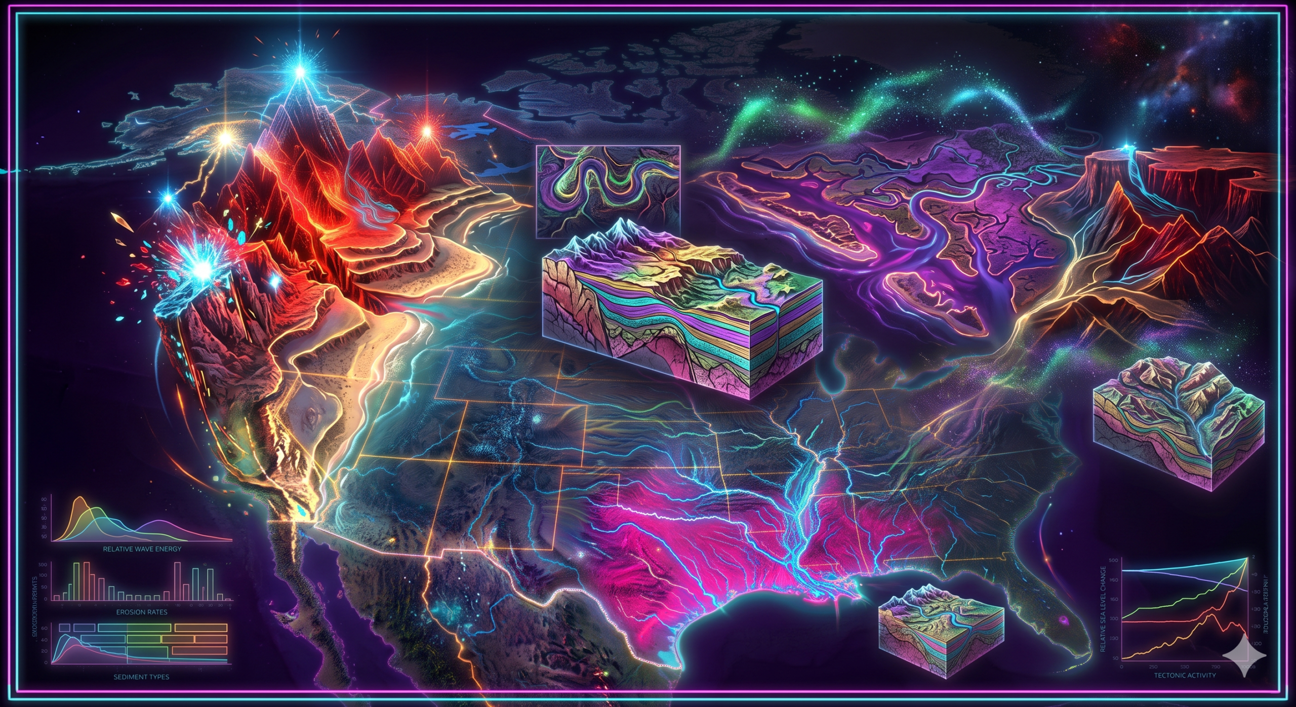
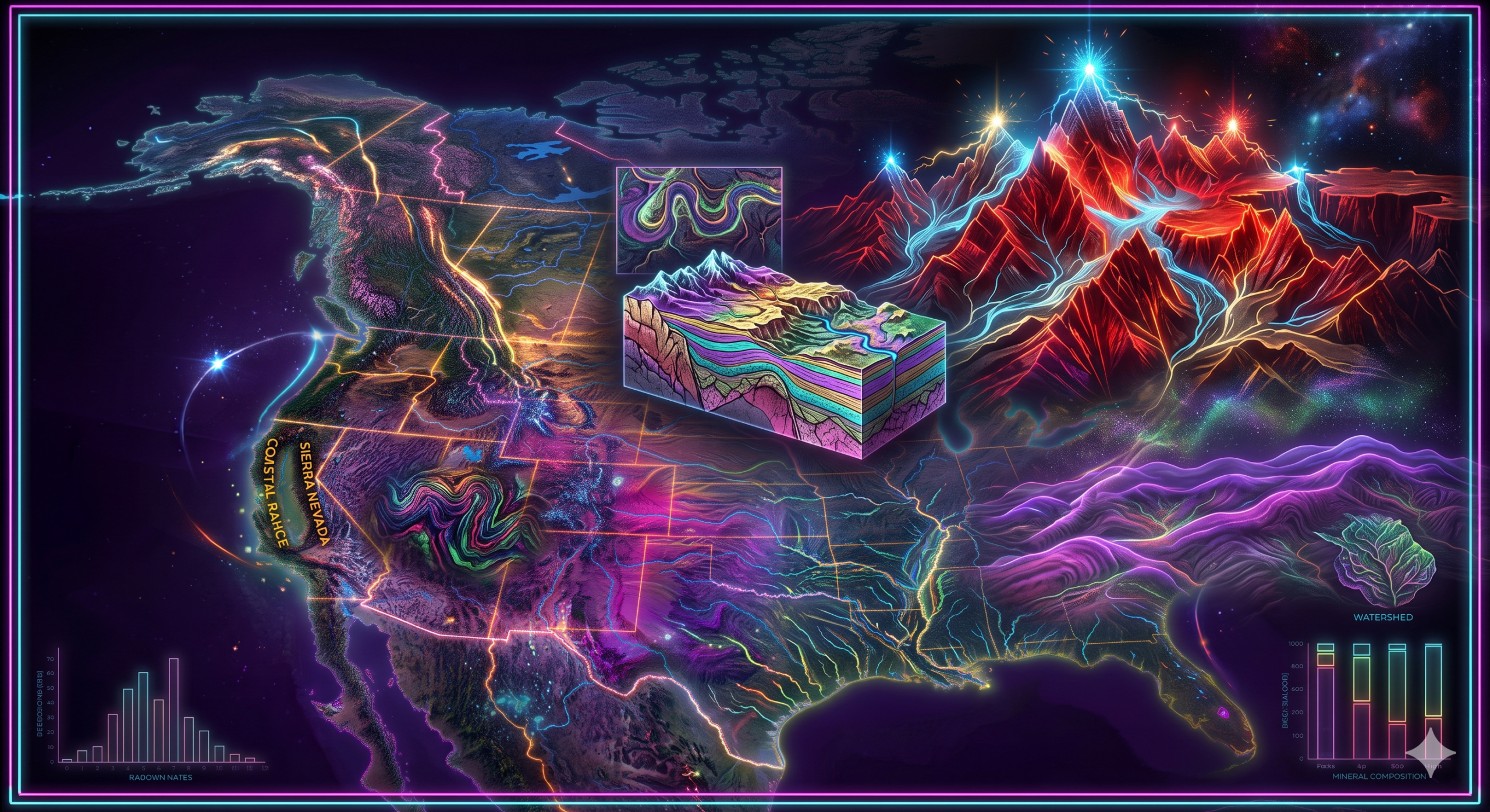
The Rocky Mountains are much more than a chain of high peaks. They are the result of millions of years of tectonic movements, mountain-building processes, volcanic activity, glaciation, weathering, and erosion. Their formation is closely linked to the movement of Earth’s lithospheric plates and the geological evolution of western North America.
From a geomorphological perspective, the Rocky Mountains are an outstanding example of a young fold mountain system. They have profoundly influenced the continent’s climate, river systems, ecosystems, mineral resources, and human settlement. Understanding their formation and geomorphological significance provides valuable insight into the dynamic processes that continue to shape Earth’s surface.
Overview of the Rocky Mountains
The Rocky Mountains are part of the larger North American Cordillera, a vast mountain system extending from Alaska to Central America.
Key Facts
- Length: Approximately 4,800 km
- Width: 110–480 km
- Highest Peak: Mount Elbert (Colorado)
- Highest Canadian Peak: Mount Robson
- Countries: Canada and the United States
- Geological Age: Primarily Late Cretaceous to Early Paleogene
- Major Mountain-Building Event: Laramide Orogeny
Geological History Before the Rockies
To understand how the Rockies formed, it is important to examine the geological history of western North America.
Hundreds of millions of years ago, western North America looked very different from today. Much of the region was covered by shallow inland seas that deposited thick layers of sediment, including sandstone, shale, and limestone. Beneath these sediments lay much older crystalline rocks.
At the western edge of the continent, an oceanic tectonic plate called the Farallon Plate was moving eastward beneath the North American Plate. This process, known as subduction, played the central role in mountain formation.
Plate Tectonics and Mountain Building
The theory of plate tectonics explains that Earth’s outer shell is divided into large moving plates. These plates constantly interact by colliding, separating, or sliding past one another.
The Rocky Mountains formed at a convergent plate boundary, where the oceanic Farallon Plate was forced beneath the continental North American Plate.
This collision generated enormous compressional forces that folded, faulted, and uplifted the Earth’s crust.
The Laramide Orogeny
The principal mountain-building event responsible for the Rockies is known as the Laramide Orogeny.
Time Period
Approximately 80 to 55 million years ago during the Late Cretaceous and Early Paleogene periods.
What Happened?
Unlike many mountain-building events where deformation occurs mainly along the continental margin, the Farallon Plate subducted at an unusually shallow angle beneath North America.
Because the plate descended almost horizontally for hundreds of kilometers, compressional forces were transmitted far inland.
These forces caused:
- Crustal shortening
- Folding of sedimentary rocks
- Large-scale faulting
- Uplift of ancient basement rocks
- Development of mountain ranges far from the coastline
This unusual style of deformation created the Rocky Mountains.
Major Stages in Rocky Mountain Formation
Stage 1: Marine Sedimentation
For hundreds of millions of years, shallow seas covered western North America.
Sediments accumulated continuously, including:
- Sand
- Mud
- Limestone
- Marine fossils
These sedimentary layers later became important components of the mountains.
Stage 2: Plate Convergence
The Farallon Plate began moving beneath North America.
Compression increased as subduction continued.
Rock layers experienced:
- Folding
- Faulting
- Thickening
Stage 3: Crustal Uplift
Powerful tectonic forces uplifted huge blocks of crust.
Older crystalline rocks rose through younger sedimentary layers.
Mountain ranges gradually developed across western North America.
Stage 4: Volcanic Activity
Subduction also produced magma.
Although the central Rockies experienced limited volcanism compared to the Cascade Range, volcanic activity occurred in surrounding regions.
Igneous rocks intruded into the crust, contributing to mountain building.
Stage 5: Erosion Begins
Immediately after uplift, erosion began modifying the mountains.
Agents of erosion included:
- Rivers
- Wind
- Ice
- Gravity
Large volumes of sediment were transported into adjacent basins.
Stage 6: Glaciation
During the Pleistocene Ice Age, alpine glaciers developed across the Rockies.
Glaciers carved:
- U-shaped valleys
- Cirques
- Arêtes
- Horns
- Moraines
- Tarn lakes
Many of today’s dramatic mountain landscapes were shaped by glacial erosion.
Geological Structure of the Rockies
The Rocky Mountains contain rocks of various ages.
Major rock types include:
Igneous Rocks
Examples:
- Granite
- Diorite
These formed from cooling magma.
Sedimentary Rocks
Examples:
- Limestone
- Sandstone
- Shale
These formed from ancient marine deposits.
Metamorphic Rocks
Examples:
- Gneiss
- Schist
- Quartzite
These formed when older rocks were altered by heat and pressure.
Geomorphological Processes Shaping the Rockies
Although tectonic uplift created the mountains, geomorphological processes continue to modify them.
1. Weathering
Weathering breaks rocks into smaller fragments.
Physical Weathering
Common mechanisms include:
- Freeze-thaw action
- Frost wedging
- Temperature changes
These processes dominate at high elevations.
Chemical Weathering
Occurs where moisture promotes:
- Dissolution
- Oxidation
- Hydrolysis
2. River Erosion
Mountain streams cut deep valleys.
Major rivers originating in the Rockies include:
- Colorado River
- Columbia River
- Missouri River
- Arkansas River
- Rio Grande
- Snake River
These rivers transport enormous amounts of sediment downstream.
3. Glacial Erosion
Ice reshaped much of the high mountain landscape.
Characteristic glacial landforms include:
- Cirques
- U-shaped valleys
- Hanging valleys
- Moraines
- Glacial lakes
- Fjord-like valleys in northern regions
4. Mass Wasting
Gravity causes movement of rock and soil through:
- Landslides
- Rockfalls
- Debris flows
- Avalanches
These processes are common on steep slopes.
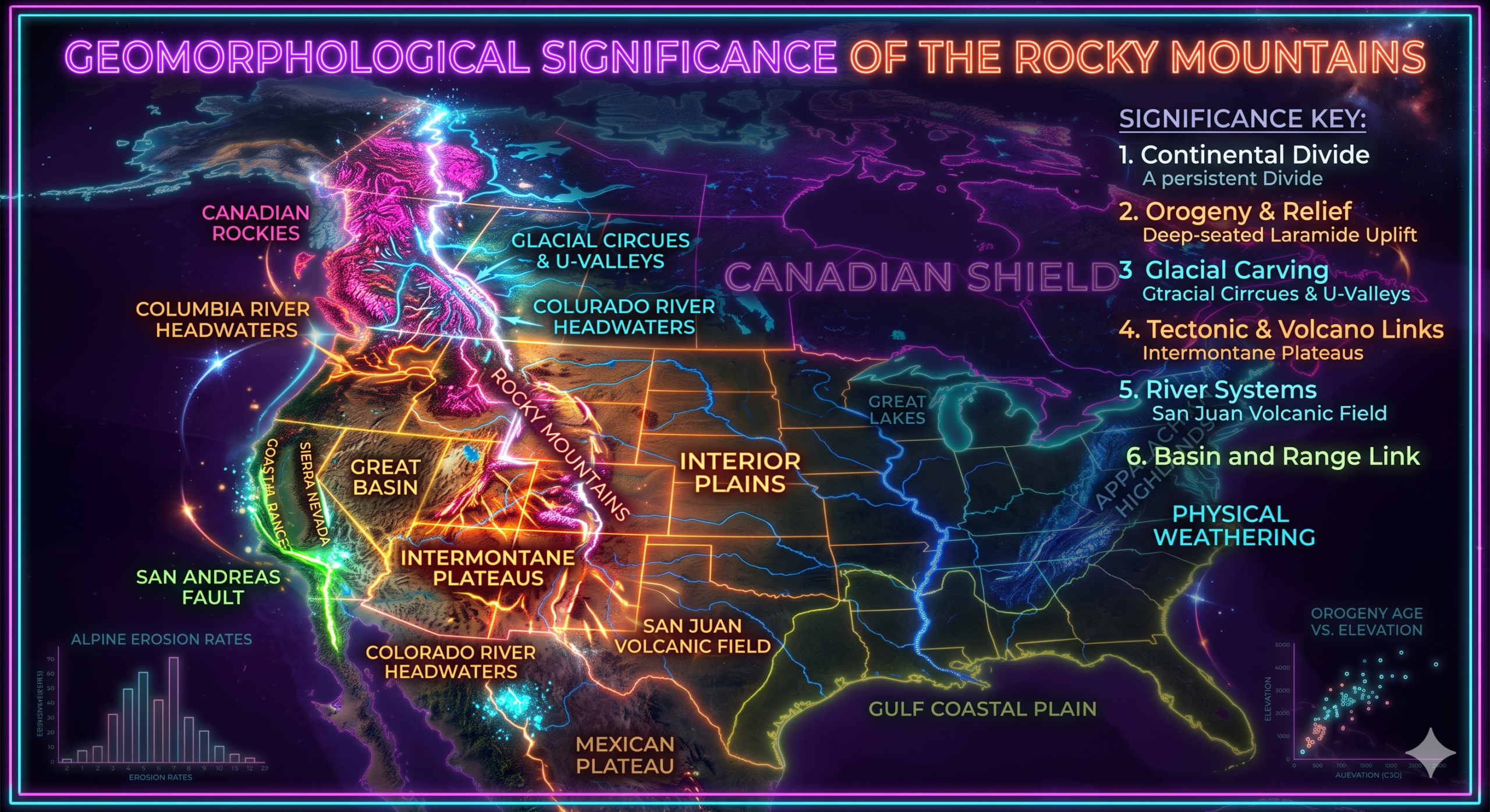
Geomorphological Significance of the Rocky Mountains
The Rocky Mountains possess immense geomorphological importance because they influence nearly every aspect of western North America’s physical environment.
1. Example of Young Fold Mountains
The Rockies are among the finest examples of young fold mountains.
Their characteristics include:
- High elevations
- Steep slopes
- Rugged peaks
- Active erosion
- Deep valleys
Compared to the much older Appalachian Mountains, the Rockies retain youthful landforms.
2. Evidence of Plate Tectonics
The Rockies provide clear evidence of plate tectonic processes.
They demonstrate:
- Continental compression
- Crustal uplift
- Faulting
- Folding
- Mountain-building mechanisms
Their formation supports modern theories of plate tectonics.
3. Watershed of North America
The Rockies form the Continental Divide, separating river systems that flow toward:
- Pacific Ocean
- Atlantic Ocean
- Arctic Ocean
- Gulf of Mexico
This makes them one of the continent’s most important hydrological features.
4. Source of Major Rivers
Many of North America’s largest rivers originate in the Rockies.
Examples include:
- Colorado River
- Missouri River
- Columbia River
- Platte River
- Rio Grande
- Arkansas River
These rivers provide water for:
- Agriculture
- Industry
- Hydroelectric power
- Drinking water
- Transportation
5. Influence on Climate
The Rocky Mountains significantly modify atmospheric circulation.
Their effects include:
- Orographic rainfall
- Snow accumulation
- Rain-shadow effect
- Temperature variation
- Wind patterns
Western slopes receive higher precipitation, while eastern plains experience drier conditions.
6. Glacial Landforms
The Rockies preserve outstanding examples of glacial geomorphology.
These include:
- Cirques
- Horns
- Arêtes
- Moraines
- Tarn lakes
- U-shaped valleys
These landforms provide evidence of past climatic conditions.
7. Rich Biodiversity
The variation in elevation creates numerous ecological zones.
These include:
- Grasslands
- Montane forests
- Subalpine forests
- Alpine tundra
The mountains support diverse wildlife, including:
- Elk
- Moose
- Bighorn sheep
- Mountain goats
- Grizzly bears
- Black bears
- Wolves
8. Mineral Resources
Mountain-building concentrated valuable minerals.
Important resources include:
- Gold
- Silver
- Copper
- Lead
- Zinc
- Molybdenum
- Uranium
Mining has played a significant role in the region’s economy.
9. Tourism and Recreation
The Rockies attract millions of visitors annually.
Popular activities include:
- Hiking
- Skiing
- Camping
- Mountaineering
- Wildlife viewing
- Photography
Famous protected areas include:
- Rocky Mountain National Park
- Banff National Park
- Jasper National Park
- Yellowstone National Park (adjacent geological influences)
Tourism contributes substantially to local economies.
10. Natural Hazard Studies
Geomorphologists study hazards associated with mountainous terrain.
These include:
- Landslides
- Rockfalls
- Avalanches
- Floods
- Earthquakes
- Debris flows
Understanding these hazards helps improve disaster preparedness and infrastructure planning.
11. Climate Change Indicators
The Rocky Mountains are important indicators of climate change.
Scientists monitor:
- Glacier retreat
- Snowpack reduction
- Changing river flows
- Permafrost degradation
- Vegetation shifts
These observations help assess long-term environmental change.
Human Importance of the Rockies
The Rocky Mountains support millions of people through:
- Freshwater supplies
- Agriculture
- Hydroelectric power
- Forestry
- Tourism
- Mining
- Transportation corridors
- Wildlife conservation
Major cities such as Denver, Calgary, and Salt Lake City are closely connected to the mountain environment.
Modern Research in Rocky Mountain Geomorphology
Geomorphologists use advanced technologies to study the Rockies.
These include:
- Satellite imagery
- LiDAR surveys
- Geographic Information Systems (GIS)
- GPS measurements
- Drone mapping
- Remote sensing
- Radiometric dating
- Climate modeling
These tools help researchers monitor erosion rates, glacier retreat, tectonic activity, and landscape evolution.
Challenges Facing the Rocky Mountains
The Rocky Mountains face several environmental challenges, including:
- Climate change
- Glacier melting
- Wildfires
- Forest pests
- Habitat fragmentation
- Mining impacts
- Urban expansion
- Water scarcity
- Increased tourism pressure
Sustainable management is essential to preserve the region’s ecological and geological heritage.
Conclusion
The Rocky Mountains are among the most significant mountain systems on Earth and represent a remarkable example of how tectonic forces shape the planet’s surface. Their formation began approximately 80 to 55 million years ago during the Laramide Orogeny, when the shallow subduction of the Farallon Plate beneath the North American Plate generated immense compressional forces that uplifted the continental crust. Over millions of years, weathering, river erosion, glaciation, and mass wasting transformed these uplifted rocks into the rugged landscapes seen today.
From a geomorphological perspective, the Rocky Mountains are invaluable because they demonstrate the interaction of tectonic activity with surface processes. They influence continental drainage, climate, biodiversity, mineral distribution, and natural hazards while preserving exceptional examples of glacial and fluvial landforms. Beyond their scientific importance, the Rockies provide essential natural resources, freshwater, recreational opportunities, and economic benefits. As climate change and human activities continue to alter mountain environments, understanding the formation and geomorphological significance of the Rocky Mountains remains crucial for education, environmental conservation, hazard management, and sustainable development.