Introduction
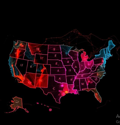
Rainfall distribution across the United States varies greatly from region to region. Among the most striking climatic contrasts is the difference between the southeastern and southwestern parts of the country. The southeastern United States, which includes states such as Florida, Georgia, Alabama, Mississippi, Louisiana, and the Carolinas, receives abundant rainfall throughout much of the year. In contrast, the southwestern United States, including Arizona, New Mexico, Nevada, and parts of California, is generally characterized by dry and semi-arid conditions.
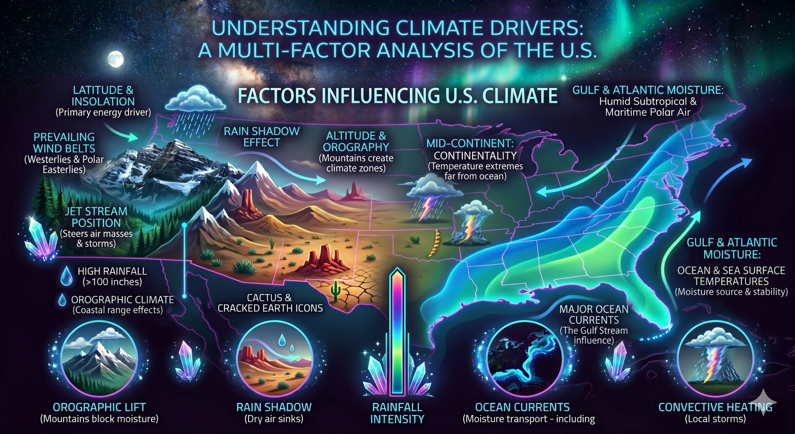
This difference in precipitation is not accidental. It results from a combination of geographical, atmospheric, and oceanic factors that influence the movement of moisture and weather systems. Elements such as proximity to large water bodies, prevailing wind patterns, mountain barriers, air masses, ocean currents, and seasonal weather systems all contribute to the rainfall differences between these two regions.
Understanding why the southeastern United States receives more rainfall than the southwestern United States helps explain regional climates, vegetation patterns, agriculture, water resources, and human settlement. This article explores the major factors responsible for this climatic contrast and highlights the importance of these factors in shaping the environment of the United States.
Geographic Location and Its Importance
One of the primary reasons for the difference in rainfall between the Southeast and Southwest is their geographic location.
The southeastern United States is located close to several major sources of moisture, including:
- The Gulf of Mexico
- The Atlantic Ocean
- The Caribbean Sea
These large bodies of warm water continuously provide moisture to the atmosphere through evaporation.
The southwestern United States, however, is located farther from major moisture sources and is surrounded by extensive desert and semi-arid landscapes. Although the Pacific Ocean lies to the west, mountain barriers often prevent significant moisture from reaching the interior Southwest.
As a result, the Southeast has a much greater supply of atmospheric moisture than the Southwest.
Influence of the Gulf of Mexico
The Gulf of Mexico is one of the most important factors contributing to rainfall in the southeastern United States.
Continuous Moisture Supply
The warm waters of the Gulf of Mexico experience high rates of evaporation throughout the year. Water vapor enters the atmosphere and is transported inland by prevailing winds.
This constant moisture source fuels cloud formation and precipitation across much of the Southeast.
Warm Ocean Temperatures
Warm water increases evaporation rates. Since the Gulf remains relatively warm even during winter months, it continues supplying moisture throughout the year.
This year-round moisture availability supports regular rainfall in southeastern states.
Influence on Humidity
The Gulf of Mexico is largely responsible for the high humidity levels commonly experienced in the Southeast. Moist air creates favorable conditions for cloud formation, thunderstorms, and rainfall.
Role of the Atlantic Ocean
The Atlantic Ocean also contributes significantly to rainfall in the southeastern United States.
Moisture Transport
Winds moving inland from the Atlantic carry large amounts of water vapor. This moisture supports rainfall along coastal and inland areas.
Coastal Precipitation
States located along the Atlantic coast receive substantial rainfall due to the proximity of warm ocean waters.
Storm Development
The Atlantic Ocean supplies moisture to tropical storms, hurricanes, and coastal weather systems that frequently affect the Southeast.
Prevailing Wind Patterns
Wind systems play a crucial role in determining where moisture is transported.
Southeastern United States
In the Southeast, prevailing winds often bring moist maritime air from the Gulf of Mexico and Atlantic Ocean.
These winds continuously replenish atmospheric moisture, increasing the likelihood of precipitation.
Southwestern United States
The Southwest is more frequently influenced by dry continental air masses originating from inland regions. These air masses contain less moisture and therefore produce less rainfall.
The difference in prevailing wind patterns helps explain the contrasting precipitation levels between the two regions.
Influence of Air Masses
Air masses are large bodies of air with relatively uniform temperature and humidity characteristics.
Maritime Tropical Air Masses
The southeastern United States is frequently affected by maritime tropical air masses originating over warm ocean waters.
Characteristics include:
- High humidity
- Warm temperatures
- Significant moisture content
These air masses are highly conducive to cloud formation and rainfall.
Continental Tropical Air Masses
The southwestern United States is often influenced by continental tropical air masses.
Characteristics include:
- Hot temperatures
- Low humidity
- Dry atmospheric conditions
Because these air masses contain little moisture, rainfall is less frequent.
Convective Rainfall and Thunderstorms
Convective rainfall is particularly common in the southeastern United States.
Formation Process
Strong solar heating warms the Earth’s surface during the day.
Warm, moist air rises into the atmosphere. As it rises, it cools and condenses into clouds.
Eventually, precipitation falls in the form of rain or thunderstorms.
Summer Thunderstorms
The Southeast experiences frequent afternoon thunderstorms during summer.
The combination of:
- High temperatures
- Abundant moisture
- Atmospheric instability
creates ideal conditions for convection.
The Southwest experiences fewer convective storms because moisture availability is generally lower.
Tropical Storms and Hurricanes
Tropical weather systems significantly increase rainfall in the southeastern United States.
Hurricane Activity
The Southeast is regularly affected by hurricanes and tropical storms originating over the Atlantic Ocean and Gulf of Mexico.
These storms transport enormous amounts of moisture inland.
Heavy Rainfall Events
A single tropical cyclone can produce several hundred millimeters of rainfall within a few days.
These storms contribute substantially to annual precipitation totals across the Southeast.
Limited Influence in the Southwest
Although remnants of tropical systems occasionally reach the Southwest, their impact is generally much weaker than in the Southeast.
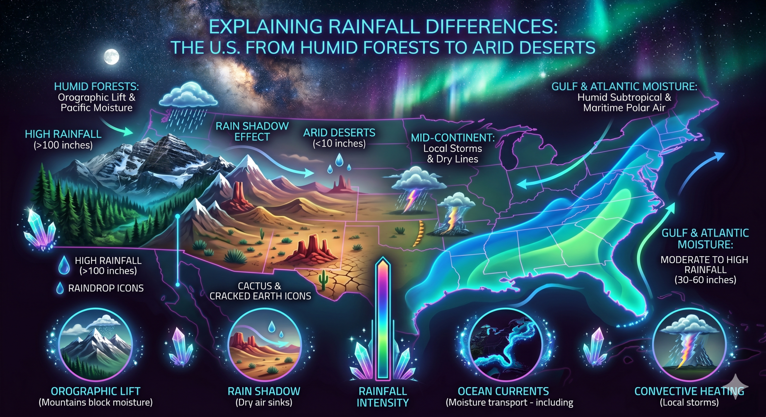
The Rain Shadow Effect
One of the most important reasons for the dryness of the Southwest is the rain shadow effect.
Mountain Barriers
Several major mountain ranges lie between the Pacific Ocean and the southwestern interior, including:
- Sierra Nevada
- Cascade Range
- Rocky Mountains
Moisture Loss
When moist Pacific air encounters these mountains, it rises and cools.
Most precipitation falls on the windward side of the mountains.
Dry Descending Air
After crossing the mountains, the air descends and becomes warmer and drier.
This creates arid conditions on the leeward side.
Much of the southwestern United States lies within this rain shadow region.
Desert Formation in the Southwest
The rain shadow effect contributes to the formation of several major deserts.
Major Deserts
The Southwest contains:
- Sonoran Desert
- Mojave Desert
- Chihuahuan Desert
These deserts receive limited rainfall due to restricted moisture supply and persistent dry air conditions.
Low Annual Precipitation
Many desert areas receive less than 250 millimeters of rainfall annually, compared with over 1,000 millimeters in many parts of the Southeast.
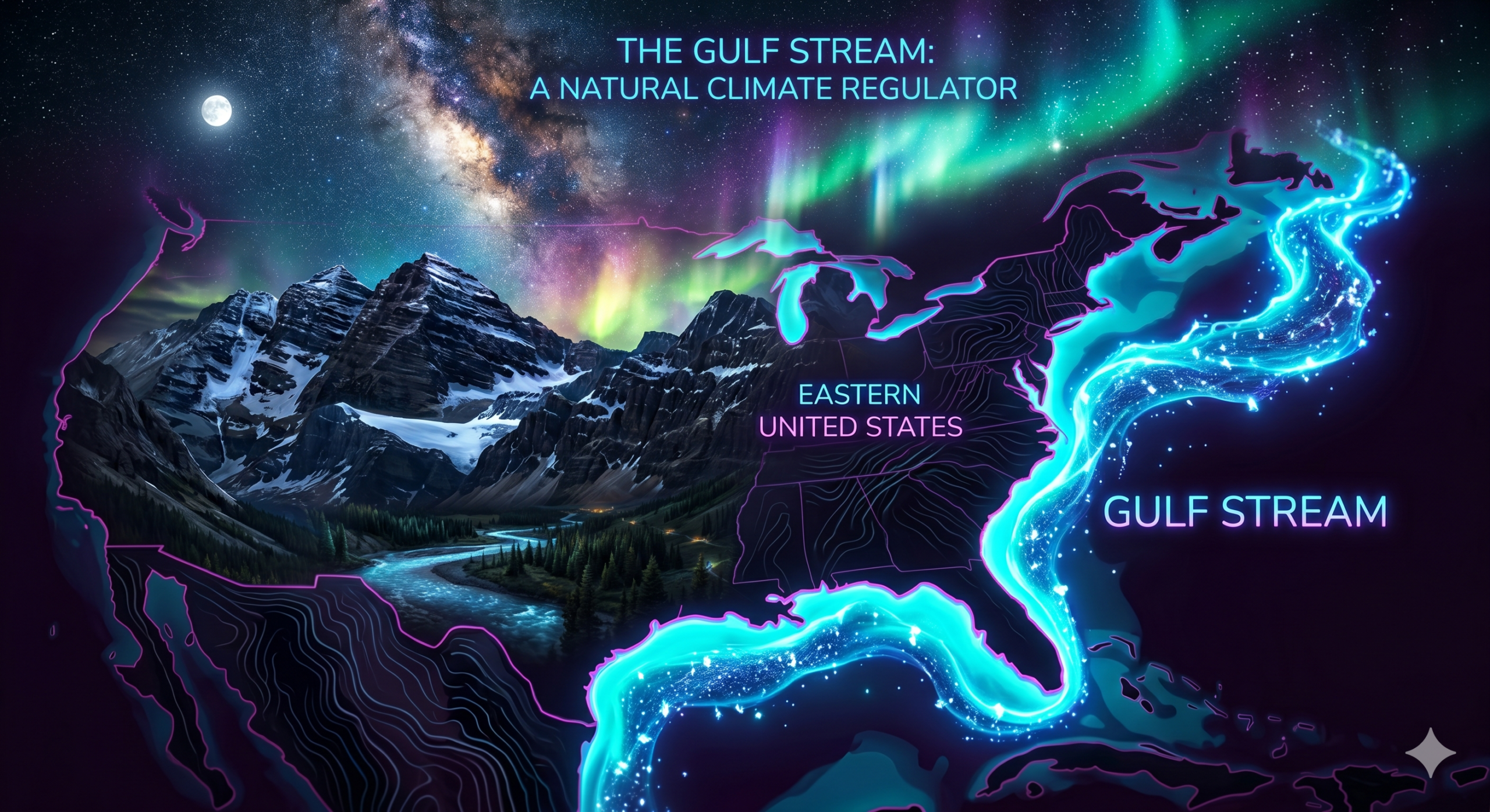
Influence of the Gulf Stream
The Gulf Stream is a warm ocean current flowing along the eastern coast of North America.
Increased Evaporation
Warm ocean waters promote evaporation and increase atmospheric moisture.
Climate Moderation
The Gulf Stream helps maintain warm temperatures and humid conditions along the eastern seaboard.
Enhanced Rainfall
The additional moisture supports cloud formation and precipitation across the southeastern United States.
The Southwest lacks a comparable warm ocean current capable of supplying similar moisture levels.
Seasonal Rainfall Patterns
Southeastern United States
Rainfall occurs throughout much of the year.
Sources include:
- Thunderstorms
- Frontal systems
- Hurricanes
- Tropical storms
This year-round precipitation helps maintain abundant water resources.
Southwestern United States
Rainfall is more seasonal and less predictable.
Many areas experience extended dry periods interrupted by occasional storms.
Although the North American Monsoon provides some summer rainfall, annual totals remain significantly lower than those in the Southeast.
The North American Monsoon
The Southwest does receive some rainfall through the North American Monsoon.
What is the Monsoon?
During summer, wind patterns shift and transport moisture from the Gulf of California and eastern Pacific Ocean into the Southwest.
Limited Duration
The monsoon season usually lasts only a few months.
Localized Rainfall
While monsoon storms can produce intense rainfall, they are often localized and do not provide enough precipitation to match southeastern rainfall totals.
Vegetation and Land Surface Feedback
Vegetation also influences rainfall patterns.
Southeast
The Southeast contains:
- Dense forests
- Wetlands
- Grasslands
Plants release moisture into the atmosphere through transpiration.
This process contributes additional humidity and supports precipitation.
Southwest
Sparse desert vegetation releases far less moisture into the atmosphere.
As a result, atmospheric humidity remains lower.
Temperature and Evaporation Differences
Southeast
Although evaporation rates are high, the continuous supply of moisture from nearby oceans compensates for water loss.
Southwest
High temperatures combined with limited moisture result in rapid evaporation.
Much of the little rainfall received is quickly lost back into the atmosphere.
This contributes to persistent dryness.
Influence on Agriculture
The rainfall contrast strongly affects agricultural activities.
Southeastern Agriculture
Abundant rainfall supports crops such as:
- Cotton
- Corn
- Soybeans
- Peanuts
- Fruits
- Vegetables
Southwestern Agriculture
Agriculture often depends heavily on irrigation because natural rainfall is insufficient for many crops.
Water must frequently be supplied from rivers, reservoirs, or groundwater sources.
Impact on Ecosystems
Rainfall differences create very different ecosystems.
Southeastern Ecosystems
The Southeast supports:
- Forests
- Swamps
- Wetlands
- Rich biodiversity
Southwestern Ecosystems
The Southwest supports:
- Deserts
- Shrublands
- Cactus communities
- Drought-adapted wildlife
These ecological differences are directly related to precipitation patterns.
Climate Change and Future Rainfall Trends
Climate change may influence rainfall patterns in both regions.
Scientists project that:
- Extreme rainfall events may become more frequent in the Southeast.
- Drought conditions may intensify in parts of the Southwest.
- Water resource management will become increasingly important.
Understanding the causes of regional rainfall differences helps scientists predict future climate changes and develop adaptation strategies.
Conclusion
The southeastern United States receives more rainfall than the southwestern United States because of a combination of geographic location, abundant moisture sources, favorable wind patterns, humid air masses, warm ocean currents, frequent thunderstorms, tropical storms, and hurricanes. The Gulf of Mexico and Atlantic Ocean provide a continuous supply of moisture that fuels precipitation throughout much of the year.
In contrast, the southwestern United States experiences lower rainfall because it is farther from major moisture sources, lies within the rain shadow of major mountain ranges, and is frequently influenced by dry continental air masses. Although seasonal monsoon rains provide some precipitation, they are insufficient to match the rainfall levels of the Southeast.
These climatic differences shape agriculture, ecosystems, water resources, population distribution, and economic activities across the United States. The contrast between the wet Southeast and the dry Southwest demonstrates the powerful influence of geography and atmospheric processes on regional climate patterns.